
The Brenta Dolomites are the westernmost part of the Dolomites and one of the nine systems of the UNESCO World Heritage Site. They are the only Dolomite group west of the Adige and lie entirely in Trentino, between the Giudicarie valleys, Val Rendena, Val di Non and Val di Sole.
The Bocca di Brenta divides them in two: to the north the Sfulmini chain and the Grostè massif, to the south Cima Tosa and the Ambiez chain. The highest peak, according to the recent surveys cited by Visit Trentino, is Cima Brenta, 3,151 metres; the most famous spire is the Campanil Basso.
The group’s peaks, huts, routes and sights are listed further down.
On the map
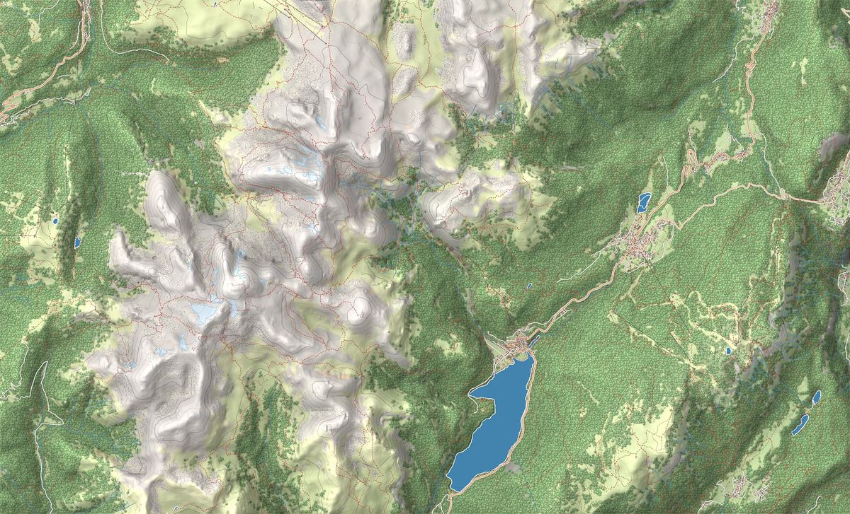
- 1Lago di Molveno Loop: the full circuit of the lake
- 2Vallesinella Waterfalls Trail from Madonna di Campiglio
- 3Via delle Bocchette Centrali: the iconic via ferrata of the Brenta
- 4Rifugio Maria e Alberto ai Brentei
- 5Rifugio Tosa Tommaso Pedrotti
- 6Lago di Molveno
- 7Cascate di Vallesinella
The best-known peaks
- Cima Tosa3,136 m
- Cima Brenta3,151 m
- Crozzon di Brenta3,130 m
- Campanile Basso2,877 m
- Cima Grostè2,901 m
Elevations from the map (OpenStreetMap).
What the group is like
The Dolomites UNESCO Foundation describes the Brenta peaks as majestic structures, shaped by erosion into spires and pinnacles. The dominant rock is the Dolomia Principale, in compact beds. Where fractures cross, the Campanil Basso, the Campanil Lungo and the Torre Vallesinella were born; small differences between one layer and the next formed the ledges, the rock balconies along which the Via delle Bocchette runs.
The rock lets water through. The Adamello Brenta park explains that water disappears underground and creates karst features such as the Vallesinella waterfalls, and that the group’s glaciers have shrunk to small patches.
The highest peak and the first ascents
Cima Tosa, first climbed, according to Visit Trentino, on 20 July 1865 by a party led by Giuseppe Loss, was then considered the highest peak in the group. Visit Trentino still gives it 3,173 metres on one page, but on another writes that after the ice on its summit melted, the latest surveys give first place to Cima Brenta, 3,151 metres. The map on this page, built on OpenStreetMap data, says the same.
Cima Brenta was climbed in 1871 by Freshfield and Tuckett, whose name lives on in a hut. The Campanil Basso gave climbers a hard time for decades, until two climbers from Innsbruck, Ampferer and Berger, reached the top. Today the Trentino mountain guides’ association offers the Via delle Normali, which links 10 of the group’s peaks in 6 stages.
Where to start
To the west the bases are Madonna di Campiglio and Pinzolo; to the east Molveno, on its lake, and Andalo; Visit Trentino also mentions San Lorenzo in Banale. From Campiglio the cable car goes up to the Grostè Pass, where the Via delle Bocchette begins. In Val di Non lies Lake Tovel.
For walkers who skip the via ferratas, there are trails linking the group’s huts, and the Dolomiti di Brenta Trek circles the whole massif over several days. The full picture is in the Brenta Dolomites guide.
The Via delle Bocchette and the huts
The Madonna di Campiglio tourist board describes it as a large network of protected paths covering the whole massif, along airy ledges. It crosses the group from north to south, always above 2,000 metres, in five or more days: from the Grostè the Benini ferrata, the Bocchette Alte to the Tuckett and Alimonta huts, then the Bocchette Centrali below the Campanil Basso, the Tosa Pedrotti hut, the Brentari ferrata, the Agostini hut, the Castiglioni route, the Dodici Apostoli hut and the Brentei hut.
Among the climbers who searched for natural passages from one hut to the next, Visit Trentino recalls, was Bruno Detassis. You need a helmet, harness and via ferrata kit: the rest is in the via ferrata guide.
Park, Geopark and UNESCO World Heritage
Since 26 June 2009 the Brenta Dolomites have been System 9 of the Dolomites UNESCO World Heritage Site: 11,135 hectares. They lie in the Adamello Brenta Nature Park, created by the Province of Trento with provincial law 18 of 1988 and now covering 620.50 square kilometres, which also includes the Adamello and the Presanella. Since 2008 the park has been part of the Geoparks network, and since 2015 it has been a UNESCO Global Geopark. In German the group is called Brenta-Dolomiten.
Trails in the group
 E · Hiking
 E · Hiking
 EEA · Via ferrata / Expert
Trail · Brenta Dolomites
Via delle Bocchette Centrali: the iconic via ferrata of the Brenta
7 h↑ 850 m8 km
Mountain huts
 2,182 m
 2,491 m
Things to see

Sight · Brenta Dolomites
Lago di Molveno
Named Italy's most beautiful lake more than once: turquoise water, grassy beaches and the Brenta Dolomites mirrored on the surface, with an easy loop that goes all the way round.

Sight · Brenta Dolomites
Cascate di Vallesinella
The karst waterfalls above Madonna di Campiglio: three sets of falls in a wood of beech and spruce, reached on an easy walk inside the Adamello Brenta Park.
Frequently asked questions
What is the highest peak of the Brenta Dolomites?
Today it is Cima Brenta, 3,151 metres: according to Visit Trentino, after the ice on Cima Tosa melted, the latest surveys give it first place. In the past Cima Tosa was considered the highest, and some pages still give it 3,173 metres.
Are the Brenta Dolomites part of the Dolomites?
Yes. They are System 9 of the Dolomites UNESCO World Heritage Site, and the Dolomites UNESCO Foundation describes them as the westernmost part of the Dolomite region.
Where does the Via delle Bocchette start?
At the Grostè Pass, reached by cable car from Madonna di Campiglio. From there the route crosses the group southwards in five or more days, from hut to hut.
Which huts are there in the Brenta Dolomites?
Along the Via delle Bocchette you pass the Tuckett, Alimonta, Tosa Pedrotti, Agostini, Dodici Apostoli and Brentei huts. Those with a page on this site are listed further down.
Who first climbed the Campanil Basso?
Two climbers from Innsbruck, Ampferer and Berger, according to Visit Trentino. For decades the spire had given even strong climbers a hard time.
Are the Brenta Dolomites in a park?
Yes, in the Adamello Brenta Nature Park, which also includes the Adamello and the Presanella and has been a UNESCO Global Geopark since 2015.