Arabba e Marmolada: what to see, do and where to stay

Veneto (BL) · 1,602 m a.s.l.

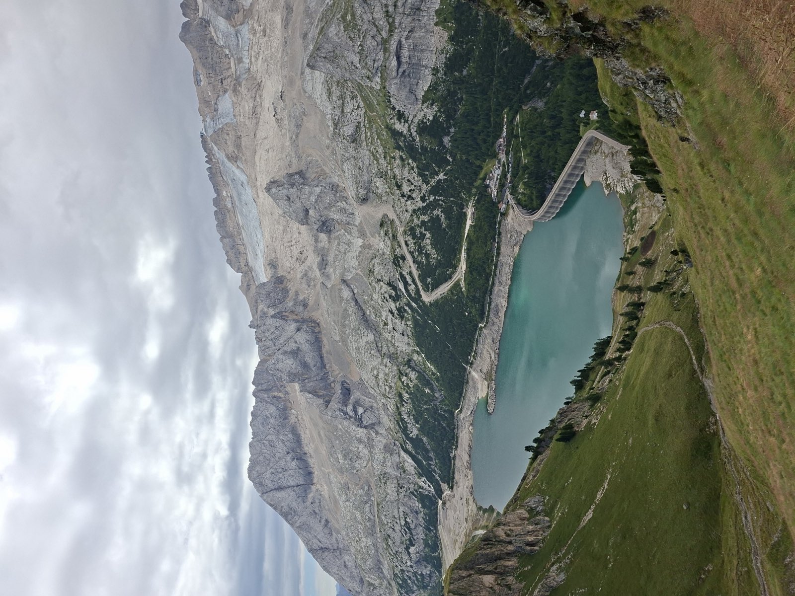
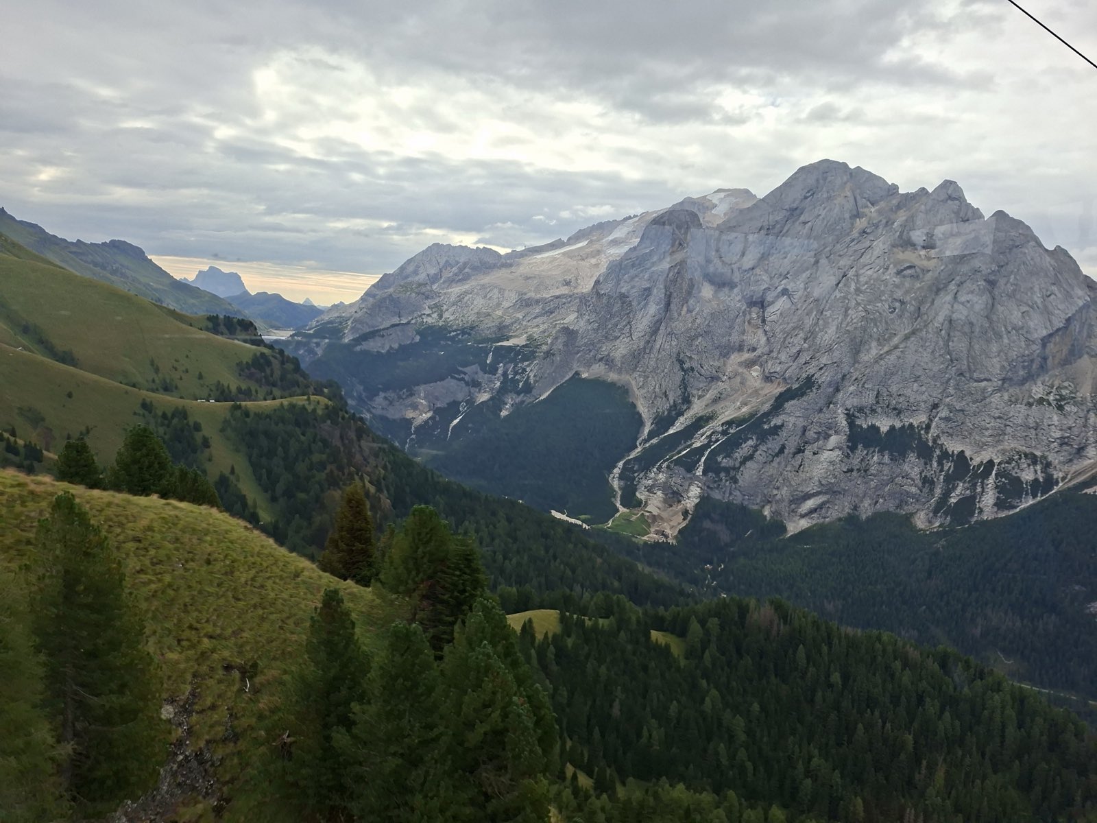
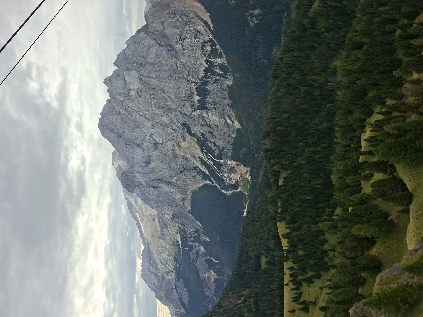
The Marmolada with its glacier on top, seen from the pastures and woods on the opposite slope, under an overcast sky

Foto: Archivio leDolomiti.it

Arabba is a small mountain village above 1,600 metres, part of the municipality of Livinallongo del Col di Lana, in the Ladin heart of the Belluno Dolomites. It sits at a crossroads. The great passes fan out from here, the Pordoi, the Campolongo, and the Falzarego, and it's one of the four corners of the Sellaronda alongside Val Badia, Val Gardena, and Val di Fassa. The altitude keeps the snow reliably good and feeds some of the steepest, most technical runs in the whole Dolomiti Superski.

Over everything rises the Marmolada, the Queen of the Dolomites. At 3,343 metres on Punta Penia it's the highest peak in the group and the only one with a glacier, now shrinking fast and acting as a kind of gauge for climate change. The cable car climbs to Punta Rocca, above 3,200 metres, where a panoramic terrace looks out over a sea of summits. Arabba has built its whole identity around this mountain.

These valleys still carry deep marks from the First World War. The nearby Col di Lana was renamed Col di Sangue, the Blood Mountain, for how savage the fighting got, and the slopes of the Marmolada were a stage for warfare at altitude, leaving behind tunnels, gun emplacements, and the museum now at the Punta Serauta cable-car station. In summer the Viel del Pan trail gives you one of the finest views of the glacier, on an easy, well-loved path.

When it is worth coming to Arabba e Marmolada, month by month: When to Go to the Dolomites: A Month-by-Month Guide.
What to seeArabba e Marmolada

The north face of the Marmolada with what is left of the glacier

Sight · Arabba e Marmolada

Ghiacciaio della Marmolada e Punta Rocca in funivia

The Queen of the Dolomites is within reach without being a mountaineer: the cable car leaves Malga Ciapela and climbs in three stages to the Punta Rocca terrace, above 3,250 metres, between the retreating glacier, the Madonna chapel and the Great War museum cut into the front line.

A First World War field gun at Serauta, on the Marmolada, among rock and snow

Sight · Arabba e Marmolada

Museo della Grande Guerra in quota

The highest museum in Europe, suspended at 3,000 metres, tells the story of the war fought inside the glacier.

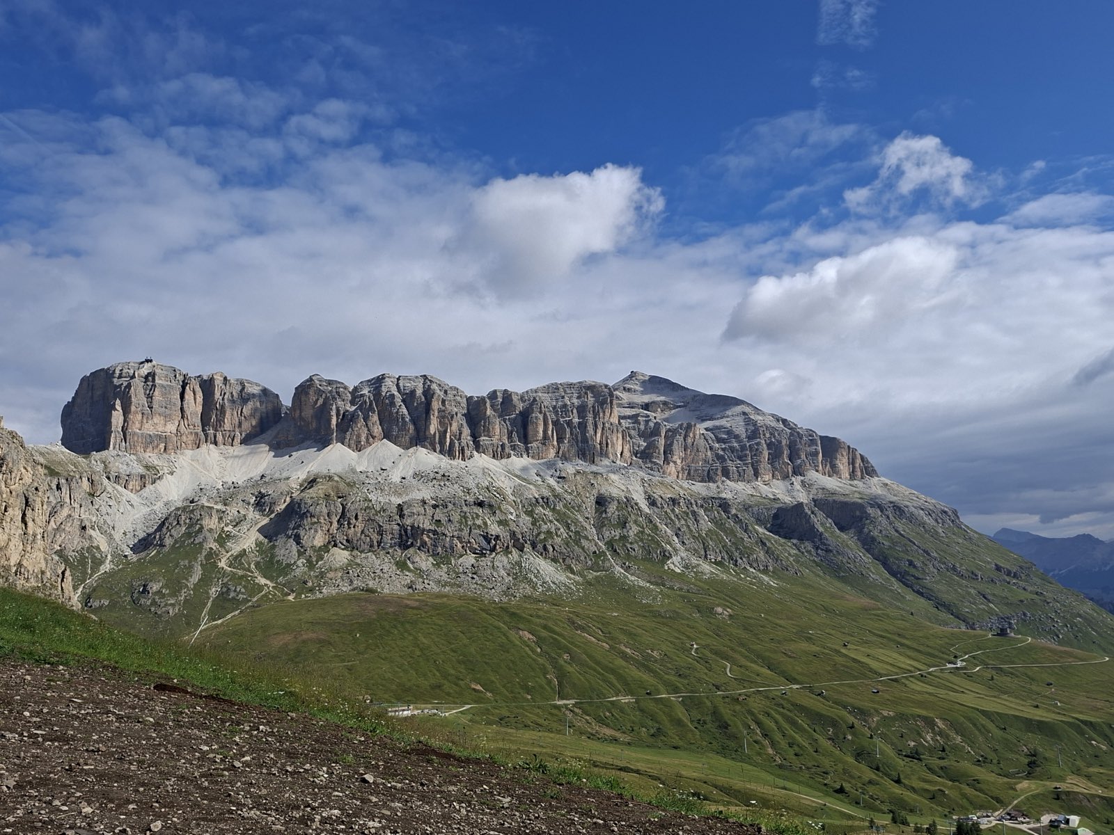
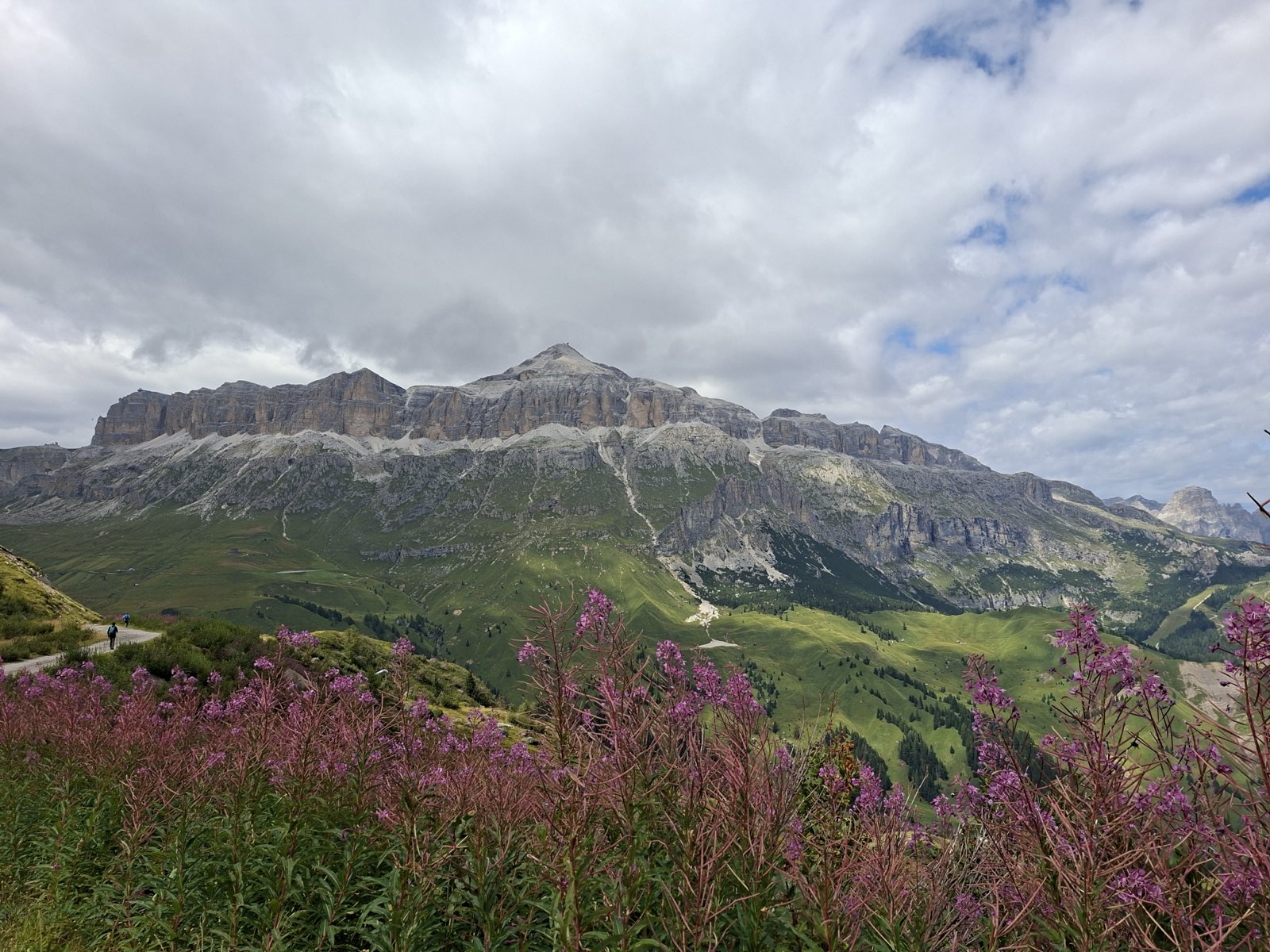
Il gruppo del Sella dal Passo Pordoi, con la stazione del Sass Pordoi in cima alla torre

Sight · Arabba e Marmolada

Passo Pordoi e snodo del Sellaronda

The key pass of the Sellaronda, crossroads for skiers and cyclists, with a cable car up to the Dolomites Terrace.

The Marmolada massif and glacier seen from the grassy slopes of the Viel del Pan trail

Sight · Arabba e Marmolada

Sentiero del Viel del Pan

The finest panoramic balcony overlooking the Marmolada, the ancient bread route between Pordoi and Fedaia.

La gola dei Serrai di Sottoguda con le pareti rocciose strette e il torrente

Sight · Arabba e Marmolada

Serrai di Sottoguda

A narrow gorge carved by the Pettorina stream, with tall walls and waterfalls, running between the village of Sottoguda and Malga Ciapela at the foot of the Marmolada.

VillagesArabba e Marmolada

See all
Pieve di Livinallongo, the main village of the municipality of Livinallongo del Col di Lana

Village · Arabba e Marmolada · 1,475 m

Livinallongo del Col di Lana

Ladin village of Fodom, whose tourist hamlet Arabba lies below the Sella, marked by the history of the Great War on the Col di Lana.

A glimpse of the village of Rocca Pietore at the foot of the Marmolada

Village · Arabba e Marmolada · 1,143 m

Rocca Pietore

Village at the foot of the Marmolada, at the mouth of the Serrai di Sottoguda, one of the most beautiful and famous gorges in the Dolomites.

Peaks, lakes and passes — Arabba e Marmolada

The highest peaks near the villages

  • Punta Penia3,343 m7.2 km from Arabba
  • Monte Civetta3,220 m8.4 km from Rocca Pietore
  • Gran Vernel3,210 m6.9 km from Arabba
  • Cima de Toni3,169 m8.8 km from Rocca Pietore
  • Piz Boè3,152 m3.7 km from Arabba
  • Ponta De Cornates3,036 m7.2 km from Arabba

The nearest lakes

  • Laghetto Pescoi2,208 m2.4 km from Arabba
  • Lago di Fedaia2,025 m4.2 km from Arabba
  • Lago di Alleghe965 m4.4 km from Rocca Pietore
  • Lago del Pisciadù2,564 m5.8 km from Arabba
  • Lago di Valparola2,140 m5.9 km from Livinallongo del Col di Lana
  • Lago Pian Da Mur2,056 m6.2 km from Arabba

The nearest road passes

  • Passo Campolongo1,875 m1.9 km from Arabba
  • Passo Fedaia2,057 m3.8 km from Arabba
  • Passo Pordoi2,239 m4.9 km from Arabba
  • Passo Valparola2,192 m5.8 km from Livinallongo del Col di Lana
  • Passo di Falzarego2,105 m5.8 km from Livinallongo del Col di Lana

Straight-line distances from the nearest village in the valley. Elevations and names from OpenStreetMap, with peaks checked against the terrain model. See the area on the map of the Dolomites.

Nearby trailsArabba e Marmolada

See all

Mountain hutsArabba e Marmolada

Il gruppo del Sella verso il Piz Boè, con l'epilobio fiorito in primo piano2,873 m

Mountain hut · Arabba e Marmolada

Rifugio Boè

78 beds

When to go & weatherArabba e Marmolada

Winter, December to April, is the prime time for Arabba's steep, technical skiing and for closing the Sellaronda loop, with snow that stays reliably good thanks to the altitude. From Punta Rocca, La Bellunese drops as the longest run in the Dolomiti Superski. In summer, June to September, the Marmolada cable car takes you up to the glacier and you can walk the Viel del Pan. July and August give the steadiest conditions up high, while September brings clear light and still-green meadows around the passes.

How to get thereArabba e Marmolada

You reach Arabba over the great Dolomite passes: the Pordoi and Campolongo from the north, the Falzarego from Cortina, or up the Cordevole valley from Belluno. On the A22, exit at Bressanone/Val Pusteria and come in through Val Badia and the passes. From the south, follow the State Road d'Alemagna. The nearest rail stations are Brunico to the north and Calalzo di Cadore to the east, both with scheduled buses, and seasonal shuttles run from the main airports. At over 1,600 metres, Arabba is one of the four junctions of the Sellaronda alongside Val Badia, Val Gardena, and Val di Fassa.

Frequently asked questionsArabba e Marmolada

Can you visit the Marmolada without being a mountaineer?

Yes. The Punta Rocca cable car takes non-experts to the top, where the panoramic terrace and the Great War museum are open to everyone. A real glacier outing, though, needs proper gear and alpine experience.

Is Arabba suitable for beginner skiers?

Arabba is best known for steep, technical runs, but there are gentler slopes too. Beginners will find plenty to work with in the neighbouring valleys linked by the Sellaronda.

How many days do you need in Arabba and the Marmolada?

Two or three days are enough to ride up to the Marmolada, walk the Viel del Pan, and explore the passes around it. If you want to ski the full Sellaronda, allow a week.

What is the Viel del Pan trail?

It's a well-known panoramic trail between the Passo Pordoi and the Passo Fedaia, with a head-on view of the Marmolada and its glacier. An easy, much-loved walk that most hikers can manage.

Which lakes are there in and around Arabba and the Marmolada?

Straight-line distance from the nearest village: Laghetto Pescoi (2,208 m, 2.4 km from Arabba); Lago di Fedaia (2,025 m, 4.2 km from Arabba); Lago di Alleghe (965 m, 4.4 km from Rocca Pietore); Lago del Pisciadù (2,564 m, 5.8 km from Arabba); Lago di Valparola (2,140 m, 5.9 km from Livinallongo del Col di Lana); Lago Pian Da Mur (2,056 m, 6.2 km from Arabba). By road or on foot the way is longer.

Which mountain passes are there in and around Arabba and the Marmolada?

The nearest road passes, straight-line from the nearest village: Passo Campolongo (1,875 m, 1.9 km from Arabba); Passo Fedaia (2,057 m, 3.8 km from Arabba); Passo Pordoi (2,239 m, 4.9 km from Arabba); Passo Valparola (2,192 m, 5.8 km from Livinallongo del Col di Lana); Passo di Falzarego (2,105 m, 5.8 km from Livinallongo del Col di Lana).