
The Tre Cime Nature Park covers 11,878 hectares in the municipalities of Toblach (Dobbiaco), Sexten (Sesto) and Innichen (San Candido). The Province of Bolzano created it with a protection decree of 22 December 1981. In German it is the Naturpark Drei Zinnen.
It lies entirely in South Tyrol, and that is what confuses people most. The park is bounded by the Puster Valley to the north, the Sexten valley to the east, the Höhlenstein valley to the west and the border with the province of Belluno to the south. Which means the toll road from Misurina, the Rifugio Auronzo car park and the south faces of the Three Peaks are outside it: they are in the Veneto.
Here you will find how the park is built, what you see, where you walk in and the bans that apply only here. The mountain itself is on our Tre Cime di Lavaredo page, and getting there by car or bus in our access guide.
Two thirds stone
The Province writes one line that explains the landscape: about two thirds of the park is covered by rock and scree slopes. Green is the minority, down in the valleys and on the few shelves.
The present shape is recent in geological terms: it was made in the last two or three million years, by water and ice. Glacier-polished humps and rounded knolls read clearly on the plateaus around the Three Peaks and in the upper Fischleintal. Lower down, scree has buried sections of the Innerfeldtal, the Fischleintal and the Rienza valley, and at those points the streams run under the stones.
The Sexten valley, the Province writes, is the best place in the whole Dolomites to understand the bedding. From a basement of quartz phyllites you climb to the Waidbruck and Val Gardena conglomerates, from which millstones were quarried for centuries, then to the Bellerophon formation and, up to 2,000 metres, to the Werfen beds, which you cannot see because forest covers them. Above, the Schlern Dolomite makes the Haunold, the Dreischusterspitze, the Rotwand, the Elferkofel and Monte Popera, and the Main Dolomite, in horizontal beds, makes the Zwölferkofel (3,094 metres), the Paternkofel (2,744) and the Three Peaks (2,999).
The water, scarce and famous
The park holds only one lake of any size, the Dürrensee (Lago di Landro), in the valley of the same name; everything else is small alpine tarns, such as the Bödenseen and the Mitteralplsee, lying on an impermeable floor of Raibl marls.
The springs count for more. The Drau rises at the foot of the Haunold, and the Rienza flows out of the lakes below the Three Peaks, near Lange Alm. Then there are the sulphurous and ferruginous springs of Bad Innichen and Bad Moos, used for centuries for cures: part of the Moos water is bottled as table mineral water.
What you see: wallcreeper, larches, chamois
The symbol of the park is neither a marmot nor an eagle: it is the wallcreeper, which climbs the walls half flying and half scrambling and uses its long bill to pull insects and spiders out of the cracks. On the same rock live the white-winged snowfinch, the alpine accentor and the golden eagle, which here raises one or two chicks a year.
Above the tree line, up to 2,800 metres, stretch grasslands no one ever cultivated: cushion sedge and blue moor grass communities, grazing the chamois like, and the song of the water pipit. Between the Haunold and the Kreuzbergpass the woods are spruce and larch; on the dry slopes of the Höhlenstein valley Scots pine grows.
The finest thing to look at, low down, are the larch meadows at the mouth of the Fischleintal and the Innerfeldtal: scattered larches, small hay barns, mowing and late-summer grazing. The Province warns that in recent decades agricultural intensification has impoverished them.
Where you enter: three valleys, and the car stays below
You enter the park on foot. The 3 Zinnen Dolomites tourist board lists three approaches: the Rienza valley from Landro, in the Höhlenstein valley; the Innerfeldtal from Innichen; the Fischleintal from Sexten. All three end at a valley-floor car park, and from there you walk.
In summer the line 444 bus runs from Toblach up to Rifugio Auronzo and has to be booked in advance. The toll road from Misurina, also by booking, starts on the Veneto side and does not cross the park: how it works is in our dedicated guide.
The visitor centre is in Toblach, inside the Grand Hotel cultural centre at Dolomitenstraße 37: three minutes from the railway station, with the Puster Valley cycle path passing the door. It is the easiest way to start without a car.
The bans that apply only here
Besides the rules common to the South Tyrolean parks — dogs under close control, drones banned, no tents, no fires, all plants protected — this park's decree contains a precise list of trails closed to bicycles.
There are seven sections, and six of them touch the Dreizinnenhütte. Among them is trail 101 between Forcella Lavaredo, on the provincial border, and the hut itself: the very section many people plan to ride as part of the Tre Cime circuit, and you cannot. The others are the hut's links to Lange Alm and Forcella di Mezzo (105), to the Rienz valley towards Wildgrabenjoch (102), to Altensteintal and the Talschlusshütte (102-103), to the Dreischusterhütte (105) and over the Büllelejoch to the Zsigmondyhütte and the Talschlusshütte (101-103), plus the Dreischusterhütte-Wildgrabenjoch section (10-11-105).
The rest of the rules, compared park by park, are in our guide to the nature parks of the Dolomites.
Climbers, war and World Heritage
These mountains were discovered by mountaineering in the second half of the nineteenth century. The first, the Province writes, were English sportsmen, and local people considered their deeds eccentric folly: the shepherd went up as far as the grass grew, the hunter as far as the chamois climbed, and the rest was the home of demons and giants. Then came Austrians and Germans, and the first porters and guides were recruited among the most experienced hunters.
From May 1915 the mountain changed use. For two and a half years a high-altitude war was fought here, and for two winters tens of thousands of soldiers had to be fed and sheltered. The plateaus around the Three Peaks are still scattered with shell fragments, and the Sextner Stein, the Province writes, is riddled like a cheese; in the Sexten cemetery Rudolf Stolz's Dance of Death recalls those years.
Since the summer of 2009 the park has been a UNESCO World Heritage Site, in the Northern Dolomites system. The visitor centre in Toblach holds the permanent exhibition on the World Heritage Site, with a large sundial explaining the cyclical return of the ice ages and a three-dimensional model of the bedding of the Sexten and Prags Dolomites. In 2026 it is open from 5 May to 31 October, Tuesday to Saturday, 9.30 am to 12.30 pm and 2.30 pm to 6 pm, free of charge.
Inside the park
Hikes
 EE · Experienced hikers
Trail · Auronzo e Misurina
Cadini di Misurina to Rifugio Fonda Savio: among the most cinematic spires
3 h↑ 450 m7 km
 T · Easy / Tourist
Trail · Auronzo e Misurina
Lago di Misurina Circuit: an easy stroll at the foot of the Tre Cime
1 h↑ 20 m2.6 km
 E · Hiking
 E · Hiking
To see

Sight · Comelico e Sappada
Gruppo del Popera e Croda Rossa di Sesto
The wild peaks that close the Comelico to the north, from the Croda Rossa di Sesto to Cima Undici: climbing country, via ferratas and First World War memories.

Sight · Auronzo e Misurina
Lago di Misurina
The pearl of the Cadore: an alpine lake at 1,754 metres, known for the purity of its air, ringed by the Cadini peaks and a short drive from the Tre Cime.
Sight · Val di Sesto (Alta Pusteria)
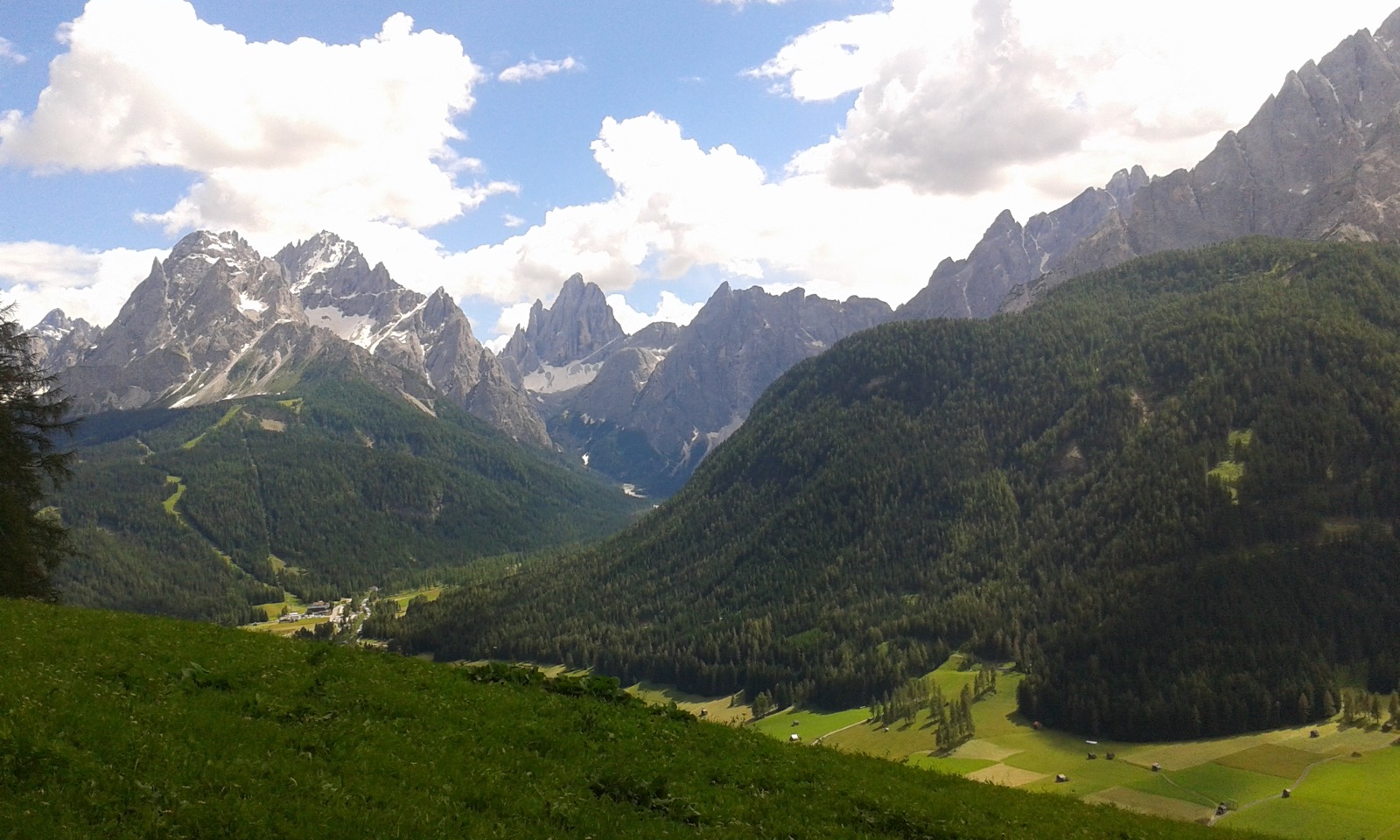
Meridiana delle Dolomiti di Sesto
Five peaks above Sesto are named after an hour, from Nine to One: the sun passes over them one after another, and the peak it stands over tells you, more or less, what time it is.

Sight · Auronzo e Misurina
Monte Piana e il museo all'aperto della Grande Guerra
A plateau where around 14,000 soldiers died between 1915 and 1917, now an open-air museum with restored trenches, tunnels and walkways.

Sight · Val di Sesto (Alta Pusteria)
Val Fiscalina
A short, spectacular valley at the foot of the Sesto Dolomites, where flat trails run beneath the peaks of the Meridiana di Sesto.
Sight · Val di Sesto (Alta Pusteria)
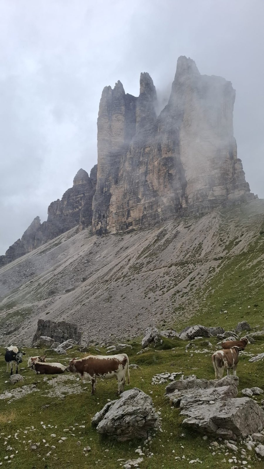
Versante nord delle Tre Cime di Lavaredo
The most formidable face of the Tre Cime, walls that made the history of mountaineering, reached from the Val Fiscalina.
Huts
 2,333 m
 2,205 m
 2,367 m
 2,405 m
Frequently asked questions
- Does the Tre Cime Nature Park include Rifugio Auronzo?
- No. The park lies entirely in South Tyrol, in the municipalities of Toblach, Sexten and Innichen, and to the south it ends at the border with the province of Belluno. The toll road from Misurina, the Rifugio Auronzo car park and the south faces are in the Veneto, outside the protected area.
- How big is the Tre Cime Nature Park?
- 11,878 hectares, according to the Province of Bolzano fact sheet, with 1,961 metres between its lowest and highest point. Toblach puts 33 per cent of its own territory inside the park, Sexten 50 and Innichen 47.
- When was the Tre Cime park established?
- In 1981: the landscape protection decree is dated 22 December 1981, no. 103/V/81, with later amendments. It is the youngest of the four Dolomite nature parks in South Tyrol.
- Where do you walk into the Tre Cime park?
- From three valleys: the Rienza valley from Landro, the Innerfeldtal from Innichen and the Fischleintal from Sexten. All three end at a valley-floor car park, from where you walk. In summer there is also the line 444 bus from Toblach, which must be booked in advance.
- Can you mountain bike in the Tre Cime park?
- Not everywhere. The park decree bans bikes on seven trails or sections, six of which touch the Dreizinnenhütte. Among them is trail 101 between Forcella Lavaredo and the hut, part of the classic Tre Cime circuit. Elsewhere the general South Tyrolean park rules apply, which recommend the official mountain bike routes.
- Where is the visitor centre and what is inside?
- In Toblach, in the Grand Hotel cultural centre at Dolomitenstraße 37, three minutes' walk from the station. It holds the permanent exhibition on the Dolomites UNESCO World Heritage Site, a large sundial on the climate eras and a three-dimensional model of the rock bedding. In 2026 it is open from 5 May to 31 October, Tuesday to Saturday, 9.30 am to 12.30 pm and 2.30 pm to 6 pm, free of charge.
- Is there only one lake in the Tre Cime park?
- Only one lake of any size, yes: the Dürrensee, in the Höhlenstein valley. The others are alpine tarns, such as the Bödenseen and the Mitteralplsee, lying on an impermeable floor of marl. The Rienza rises from the lakes below the Three Peaks, near Lange Alm.