
The Croda Rossa d'Ampezzo, Hohe Gaisl in German, is the massif that closes the Cortina basin to the north and stands on the border between the Veneto and South Tyrol, above the Braies (Prags) valley and the Val di Landro. The summit is 3,146 metres high, according to the Ampezzo Dolomites Nature Park. The name, red rock, comes from the colour of the stone, Cortina's tourist office writes.
It should not be confused with the Croda Rossa di Sesto, Rotwand in German, which lies in the Sexten Dolomites and has a page of its own. Lago di Braies and Lago di Dobbiaco, listed below because they fall in the same area of our map, are in the nearby valleys: Lago di Braies mirrors the Croda del Becco (Seekofel).
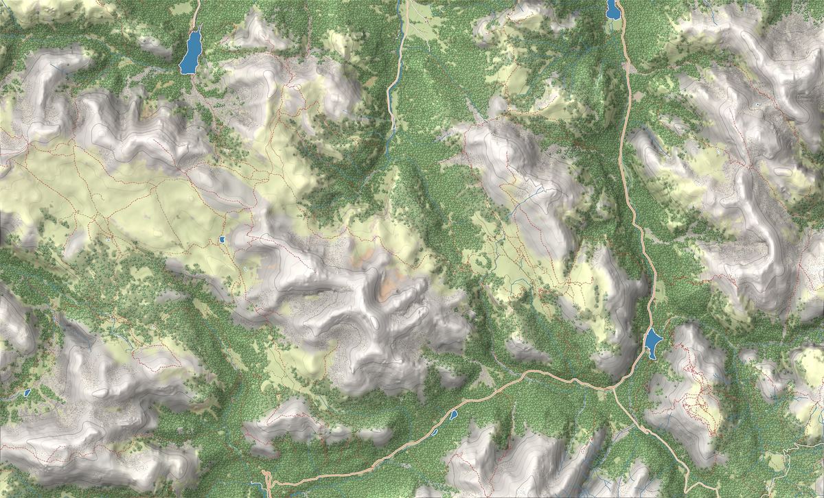
On the map
- 1Lago di Braies Loop: the easy circuit around the Pearl of the Dolomites
- 2Lago di Dobbiaco Loop: an easy walk in the Alta Pusteria
- 3Dobbiaco–Cortina Cycle Path: the great Dolomites railway trail
- 4Lago di Braies e le barche di legno
- 5Lago di Dobbiaco
The best-known peaks
- Croda Rossa d'Ampezzo3,140 m
- Crodaccia Alta3,015 m
- Piccola Croda Rossa2,860 m
Elevations from the map (OpenStreetMap).
How the mountain is built
Its peaks are not made of dolomite: according to the Province of Bolzano they are formed by the pale beds of Dachstein limestone and the grey Jurassic limestones, like those of the nearby Croda del Becco. The Dolomites UNESCO Foundation notes that it still holds small patches of active ice.
The Ampezzo park describes it as the innermost massif of the Ampezzo Dolomites, with a markedly continental climate: at the treeline larches and stone pines grow, such as the centuries-old ones of Alpe di Lerosa, and ibex live on the southern cliffs. Between the Croda Rossa Piccola and the Croda del Becco there is a karst system with deep caves, some still unexplored.
Where to see it from and how to get there
On the Braies side the starting point is Prato Piazza (Plätzwiese), the plateau at 2,000 metres in the Fanes-Senes-Braies Nature Park, facing the Croda Rossa. A toll road climbs to it from Ponticello (Brückele): in 2026 the toll applies from 6 June to 8 November, no more than 100 cars may be on the road at a time and, depending on the season, driving up is generally allowed before 10 am and after 3 pm. In summer there is the line 443 bus from Dobbiaco (Toblach), Villabassa (Niederdorf) and Monguelfo (Welsberg).
From Cimabanche (Gemärk), at the head of the Val di Landro, trail 18 climbs to Prato Piazza. From Prato Piazza trail 3 runs along the foot of the Croda Rossa to Malga Rossalm: it is narrow and stony, with a few sections secured with a rope. On the Cortina side you enter from the Boite valley towards Alpe di Lerosa, a little over an hour's walk from Ra Stua according to the park.
The First World War
The Croda Rossa was an Austro-Hungarian position: the works on the massif, which overlooks the Strada d'Alemagna, were meant to stop the Italian advance to the north, Cortina's tourist office writes. The most important peak for its history is the Croda de R'Ancona, 2,366 metres, chosen for its view in every direction, from Cristallo to the Tofane.
Beside it stands the stronghold of Son Pòuses, with fortifications, tunnels and a relic of the double-headed eagle coat of arms. Italian remains are found only on the lower slopes of the Croda de R'Ancona, because the attempts to take it failed, and many remains have been left to decay. The park suggests Son Pòuses as a walk: 4 kilometres and 400 metres of ascent.
Two nature parks and UNESCO World Heritage
The Ampezzo Dolomites Nature Park covers the northern half of the municipality of Cortina, with the Tofana, the Cime di Fanes, Col Bechei, the Croda Rossa and Cristallo; its symbol, Sempervivum dolomiticum, is the flower of the karst ground between the Croda Rossa Piccola and the Croda del Becco.
On the Braies side the mountain lies in the Fanes-Senes-Braies Nature Park, established in 1980. At Prato Piazza, the Province of Bolzano recalls, ski lifts, tennis courts, a holiday village and large car parks had already been planned, and the park saved it at the last moment. The Croda Rossa is part of the Northern Dolomites system of the UNESCO World Heritage Site, explained on our Dolomites UNESCO page.
The names
In German the Croda Rossa d'Ampezzo is the Hohe Gaisl and the Croda Rossa Piccola is the Kleine Gaisl, as the decree of the Fanes-Senes-Braies Nature Park puts it. The name Rotwand refers instead to other mountains, such as the Croda Rossa di Sesto: if you are looking for the Hohe Gaisl, look above Braies and Cortina, not above Sesto.
Trails in the group
 T · Easy / Tourist
Trail · Val Pusteria e Lago di Braies
Lago di Braies Loop: the easy circuit around the Pearl of the Dolomites
1 h 15↑ 30 m3.5 km
 T · Easy / Tourist
Trail · Val di Sesto (Alta Pusteria)
Lago di Dobbiaco Loop: an easy walk in the Alta Pusteria
1 h 15↑ 40 m4 km
 E · Hiking
Trail · Val di Sesto (Alta Pusteria)
Dobbiaco–Cortina Cycle Path: the great Dolomites railway trail
3 h 30↑ 200 m30 km
Things to see

Sight · Val Pusteria e Lago di Braies
Lago di Braies e le barche di legno
Lago di Braies, Pragser Wildsee in German, is an alpine lake at 1,496 metres in the Val Pusteria, famous for its emerald-green water, the historic boathouse and the wooden rowing boats at the foot of Croda del Becco. In summer access to the valley is regulated: book online or arrive early.

Sight · Val di Sesto (Alta Pusteria)
Lago di Dobbiaco
Lake Dobbiaco (Toblacher See) is a landslide-dammed lake at 1,251 metres, on the road that drops from Dobbiaco towards Landro and Cortina. A flat path loops around it in a little over an hour, rowing boats and pedalos run in summer, and in winter the basin turns into one of the cross-country skiing hubs of the Dolomites.
Nearby
Places that fall inside the group’s frame but are closer to another group.
Frequently asked questions
How high is the Croda Rossa d'Ampezzo?
3,146 metres, according to the Ampezzo Dolomites Nature Park, which counts it among the ten peaks above 3,000 metres in the municipality of Cortina.
What is the Croda Rossa d'Ampezzo called in German?
Hohe Gaisl; the Croda Rossa Piccola is the Kleine Gaisl. It should not be confused with the Croda Rossa di Sesto, which is called Rotwand in German.
Where is the best view of the Croda Rossa d'Ampezzo?
From Prato Piazza, the plateau above the Braies valley, which faces it. On the Veneto side it closes the Cortina basin to the north.
How do you get to Prato Piazza?
By the toll road from Ponticello in the Braies valley, which in 2026 is tolled from 6 June to 8 November, with a limited number of cars and set driving times. In summer there is also the line 443 bus from Dobbiaco, Villabassa and Monguelfo.
Is the Croda Rossa d'Ampezzo in South Tyrol or in the Veneto?
Both. The Braies side is in the Fanes-Senes-Braies Nature Park, in South Tyrol; the Cortina side is in the Ampezzo Dolomites Nature Park, in the Veneto.
Are there First World War remains on the Croda Rossa?
Yes. The massif was an Austro-Hungarian position: remains of military works are found on the Croda de R'Ancona and in the Son Pòuses stronghold, many of them left to decay, according to Cortina's tourist office.