
Antelao is the second-highest peak in the Dolomites after the Marmolada: 3,264 metres, according to the Dolomites UNESCO Foundation. It stands in Cadore, above San Vito di Cadore, between the Boite valley and Val d'Oten, and to the north Forcella Piccola separates it from the Marmarole. Rifugio San Marco puts it this way: if the Marmolada is the queen of the Dolomites, the Antelao is the king, and together with the Pelmo it forms the gateway to Cadore.
The summit is for experienced mountaineers, now more than before, because in 2014 a rockfall changed the normal route. Hikers see it up close from the huts at its base. Peaks and nearby places on this site are listed further down.
On the map
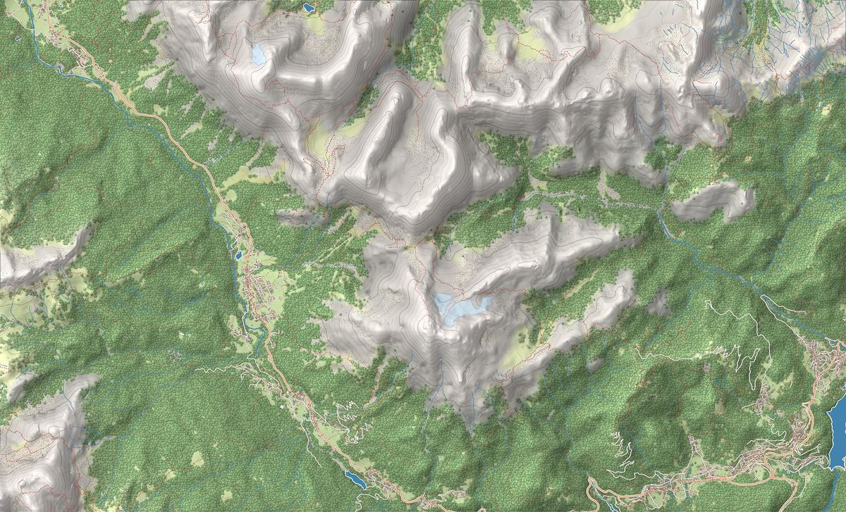
The best-known peaks
- Antelao3,264 m
- Punta Menini3,168 m
Elevations from the map (OpenStreetMap).
How it is built and what the rockfall changed
Antelao is a massif of its own and still carries ice: Rifugio Chiggiato, across Val d'Oten, describes the view of the Antelao and its glacier, and Rifugio San Marco offers a crossing of the Antelao glaciers.
In autumn 2014 a rockfall brought down the Laste, a stretch of the ascent route, into the Antermoia glacial basin. In August 2015 a heavy storm carried the debris down the valley, damaging ski lifts and the village of San Vito. The collapse also hit the Cosi bivouac, which stood at 3,100 metres below the summit.
Where to start
The base for the summit is Rifugio Galassi, 2,018 metres, run by the Mestre section of the Italian Alpine Club (CAI), at Forcella Piccola. There are two starting points, both reachable by public transport:
- From San Vito di Cadore, 1,010 metres: trail 228 climbs to Rifugio Scotter, 1,580 metres, then trails 229 and 227 lead to the Galassi, in 1 hour 45 minutes to 2 hours from the Scotter. The hut asks you not to take the tracks that drop straight to the hairpin above the Scotter. In summer the chairlift does not run.
- From Calalzo di Cadore: a paved road leads to Praciadelan, 1,046 metres, with a large car park. From there a 6.5 km dirt road, open to traffic but sometimes rough, reaches Capanna degli Alpini, 1,385 metres, and trail 255 climbs to the Galassi in 1 hour 45 minutes to 2 hours.
Climbing to the summit
The normal route starts from Forcella Piccola and follows the north ridge. Rifugio San Marco recommends it only for experienced climbers, in good weather and preferably with a local mountain guide. Since the rockfall, it writes, the line of ascent seems to change every year, the ridge is covered in loose debris, from small stones to large boulders, and the rock is dangerous especially on the way down, also for anyone below. For the night before, it suggests the San Marco, at 1,823 metres, or the Galassi.
If you are not going to the top, the Galassi suggests the Praciadelan-Galassi-Praciadelan loop and the Antelao nature and glaciology trail. More ideas are in our trekking guide and our mountain hut guide.
History: a San Vito hunter and an Austrian pioneer
The first ascent is usually credited to the Austrian Paul Grohmann, who in 1863 was guided up the Laste by Matteo Ossi, an old chamois hunter from San Vito. According to Rifugio San Marco, Ossi had already reached the summit years earlier.
The Galassi has a military history too. The shelter was built in 1903-05 along the Linea Gialla for mountain troop training, inaugurated on 19 October 1913, named after Lieutenant Pietro Galassi, and remained a barracks until 1928. Since 1950 it has belonged to the Mestre section of the CAI, and since 1970 volunteer members have taken turns running it.
Names and UNESCO World Heritage
The name is the same in every language: Antelao, including in the German and English texts of the Dolomites UNESCO Foundation. The Foundation places the massif in the Cadore Dolomites, the south-eastern part of the Northern Dolomites, one of the nine World Heritage systems. Antelao is not in a nature park: with the Marmarole and the Sorapiss it forms the Natura 2000 special area of conservation “Gruppo Antelao Marmarole Sorapis”.
Nearby
Places that fall inside the group’s frame but are closer to another group.
Frequently asked questions
How high is the Antelao?
3,264 metres. The Dolomites UNESCO Foundation calls it the second-highest peak in the Dolomites after the Marmolada.
Why is the Antelao called the king of the Dolomites?
Because of its height, second only to the Marmolada. Rifugio San Marco writes: if the Marmolada is the queen of the Dolomites, the Antelao is the king.
Can you climb the Antelao without a guide?
Rifugio San Marco recommends the normal route only for experienced climbers, in good weather and preferably with a local mountain guide: since the 2014 rockfall the line changes from year to year and the north ridge is covered in loose debris.
Where do you park for Rifugio Galassi?
At Praciadelan, above Calalzo di Cadore, where there is a large car park; a dirt road then leads to Capanna degli Alpini and trail 255 to the hut. From San Vito di Cadore you walk up via Rifugio Scotter instead.
Who made the first ascent of the Antelao?
The first ascent is usually credited to Paul Grohmann, in 1863, guided by the hunter Matteo Ossi of San Vito, who according to Rifugio San Marco had already been to the top.