
The Marmarole are a long range in Cadore, between Val d'Ansiei, where Auronzo lies, and the villages of Calalzo and Lozzo di Cadore. The highest summit is Cimon del Froppa, 2,932 metres, which the Auronzo section of the Italian Alpine Club (CAI) calls the highest point of the demanding Marmarole group. No peak in the group reaches 3,000 metres.
To the west the range ends at Cima Scotter, and Forcella Piccola separates it from the Antelao. To the north it drops to the Somadida forest, to the south to the Pian dei Buoi plateau and Val d'Oten. Peaks and nearby places on this site are listed further down.
On the map
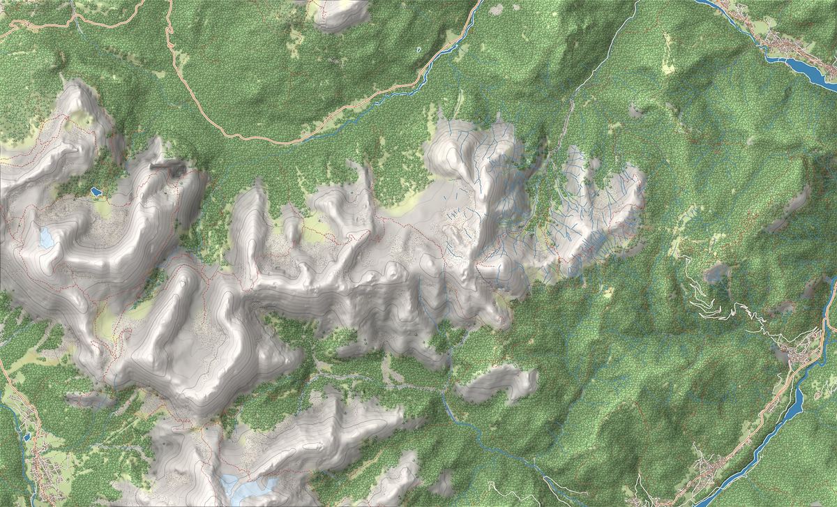
The best-known peaks
- Cimon del Froppa2,932 m
- Pala di Meduce2,850 m
- Croda Bianca2,841 m
Elevations from the map (OpenStreetMap).
How the range is built
The Marmarole are a long rock rampart, with high notches between one summit and the next. To cross it from south to north, the Auronzo CAI explains, you go through Forcella Jau de la Tana, a very demanding gap; towards Cimon del Froppa come the Froppa, Marmarole and Kugy notches. After the Froppa the highest summit is Croda Bianca, 2,841 metres, behind Rifugio Chiggiato.
On the north side, in the Somadida reserve, the main rocks are Dolomia Principale and the Jurassic Calcari Grigi, rich in fossils of oyster-like bivalves. Between the Marmarole and the Sorapiss the reserve points to the Corno del Doge, an isolated spire it has taken as its symbol.
The south side: Rifugio Chiggiato
On the south side the base is Rifugio Chiggiato, 1,911 metres, on Col Negro above Calalzo di Cadore. The hut lists three starting points:
- From Calalzo, at the small Caravaggio church, where you leave the car: via La Stua and the Costapiana hay barns, then through the woods and up a mule track.
- From Praciadelan, above Calalzo, with a large car park: trail 260 looks over Val d'Oten and the Antelao with its glacier. With a 4x4 you can drive up to the Diassa car park.
- From Pian dei Buoi, above Lozzo di Cadore: trail 262 starts at Rifugio Baion, with protected sections that you can avoid by going via the Aieron huts. In July and August the road to Pian dei Buoi runs one way at a time: up from 9 am to 1 pm, down from 2 pm to 5 pm.
The north side: the Somadida reserve
The north side is seen from Val d'Ansiei. From Auronzo di Cadore, the village on Lake Santa Caterina, road 48 towards Misurina leads to Palus San Marco. Next to the Carabinieri alpine training centre is the car park from which a path enters the Somadida nature reserve and reaches the Tre Sorelle visitor centre.
The reserve covers 1,676 hectares and climbs from the valley floor to the rocks of the Marmarole and the Sorapiss. You may only visit it on the official trails, from routes for people with limited mobility to via ferratas; some high bivouacs can only be reached on protected CAI trails.
What to do: multi-day loops and a hard summit
The longest tour is the Marmarole Runde, a hut-to-hut loop around the group that the Chiggiato puts at 4 to 6 days. The hut also lies on a variant of the Alta Via no. 5, dedicated to Titian, which runs from Sesto to Pieve di Cadore in 7 stages. To plan your nights, see our mountain hut guide.
Cimon del Froppa is not a summit for hikers. On the ascent described by the Auronzo CAI you start at the Chiggiato, cross Forcella Jau de la Tana over steep scree and protected sections, and reach the top via grade II and III climbing: 1,200 metres of ascent, 9.5 to 10 hours of walking, with helmet, harness and via ferrata kit mandatory.
History, names and UNESCO World Heritage
In the fifteenth century the Magnifica Comunità Cadorina gave the Somadida forest to the Republic of Venice, which took timber from it for its ships. After 1866 it passed to the Italian state, since 1972 it has been a nature reserve, and today it is managed by the Carabinieri biodiversity unit.
The name does not change in other languages: the German and English texts of the Dolomites UNESCO Foundation also write Marmarole. The Foundation places them in the Northern Dolomites, one of the nine World Heritage systems, and writes that the Cadore Dolomites are dominated by Sorapiss, Marmarole and Antelao. The group is not in a nature park: with Antelao and Sorapiss it forms the Natura 2000 special area of conservation “Gruppo Antelao Marmarole Sorapis”.
Things to see

Sight · Auronzo e Misurina
Lago di Santa Caterina ad Auronzo
The two-kilometre turquoise lake that runs through Auronzo di Cadore: lakeside walks, canoes and pedalos. Swimming, however, is not allowed.
Nearby
Places that fall inside the group’s frame but are closer to another group.
Frequently asked questions
What is the highest peak of the Marmarole?
Cimon del Froppa, 2,932 metres, which the Auronzo CAI calls the highest point of the group. Rifugio Chiggiato gives Croda Bianca, 2,841 metres, as the second.
Where do you park for Rifugio Chiggiato?
At the Caravaggio church in Calalzo, at Praciadelan above Calalzo, where there is a large car park, or at Pian dei Buoi, near Rifugio Baion. With a 4x4 you can reach the Diassa car park.
Can you walk all the way round the Marmarole?
Yes, on the Marmarole Runde, a hut-to-hut loop that the Chiggiato puts at 4 to 6 days.
Is Cimon del Froppa difficult?
Yes. The Auronzo CAI grades it EEA, with grade II and III passages, 1,200 metres of ascent from the Chiggiato and 9.5 to 10 hours of walking. Helmet, harness and via ferrata kit are mandatory.
Are the Marmarole a UNESCO World Heritage Site?
Yes, they are part of the Northern Dolomites, one of the nine World Heritage systems.