
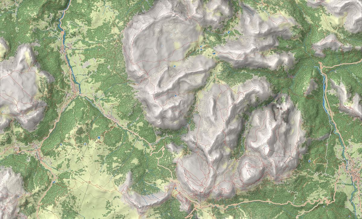
The Fanes Group lies east of Val Badia, between San Vigilio di Marebbe, San Cassiano and Cortina d'Ampezzo, and takes its name from the Fanes alp, the plateau at its centre. Its highest summit is Piz dles Cunturines, or Conturines: 3,064 metres according to Alta Badia. Next come La Varella, 3,055, and Cima Dieci, 3,026.
It is split between two regions. The peaks above Val Badia and the Fanes and Sennes plateaus are in South Tyrol, inside or on the edge of the Fanes-Sennes-Prags Nature Park. The Cortina side, with Val di Fanes, Col Bechei, the Fanis peaks and the Lagazuoi, is in the Veneto, in the Ampezzo Dolomites Nature Park. Peaks, huts and routes on this site are listed further down.
On the map
- 1E-bike Tour on the Pralongià Plateau in Alta Badia
- 2Ski Touring to Col de Locia: skinning up from Capanna Alpina, Alta Badia
- 3Fanes Plateau to Rifugio Lavarella: into the Kingdom of the Fanes
- 4Rifugio Lavarella
- 5Altopiano del Pralongià
- 6Borgo di La Val e prati di Armentara
- 7Parco Naturale Fanes-Senes-Braies
- 8Altopiano e laghi di Fanes
The best-known peaks
- Piz dles Cunturines3,064 m
- La Varella3,055 m
- Cima Dieci3,026 m
Elevations from the map (OpenStreetMap).
How it is built: a plateau ringed by walls
The heart of the group is a plateau. The Fanes and Sennes plateaus, the Province of Bolzano writes, are shaped by karst: limestone pavements, fissures, shafts, dolines and caves. On the Fanes alp stand the Fanes and Lavarella huts, the latter at 2,050 metres, and the small lakes described on our plateau page.
All around rise the walls. Above Val Badia a ridge runs from Sas dla Crusc, 2,907 metres, to Cima Dieci, La Varella and the Conturines. To the south the group reaches the Fanis peaks and the Lagazuoi, above the Falzarego Pass. To the east Val Travenanzes, a valley with no roads or huts, separates it from the Tofane.
Where to enter
There are four access points, one for each valley:
- From San Vigilio di Marebbe you reach Pederü, 1,548 metres, the start of the route to the plateau and Rifugio Lavarella. San Vigilio has the park visitor centre.
- From Alta Badia you start at Capanna Alpina, 1,726 metres, above Armentarola: trail no. 11 climbs to Col de Locia, 2,069 metres, and onto the plateau. In winter it is a skinning route.
- From the Falzarego Pass the cable car goes up to Rifugio Lagazuoi, at 2,752 metres, at the southern end of the group.
- From Cortina, starting at the Fiames visitor centre, you follow the gorge of the Fanes stream to the waterfalls, on a partly protected path.
What to do: the plateau, the Alta Via 1 and the four peaks
The easiest way to get to know the group is to walk up to the plateau and wander between huts and lakes. The Alta Via 1 crosses it: in the Province of Belluno guide, stage three runs from Rifugio Fanes to Rifugio Lagazuoi, with 5 hours of walking and 1,070 metres of ascent.
If you are experienced, Alta Badia offers the 4 Peaks: Sas dla Crusc, Cima Dieci, La Varella and Conturines, from the Santa Croce hospice above Badia to Capanna Alpina. The tourist board rates it difficult, 24.4 km, 10 hours and 2,000 metres of ascent, with harness, carabiners and helmet, and advises against going alone.
The Conturines bear and the Great War
The best-known story of the group comes from a cave below the Conturines, where the remains of a cave bear were found. For the Museum Ladin, which dedicates its Ursus ladinicus museum in San Cassiano to it, this is the oldest dated cave known so far in the Alps and the highest site in the world with remains of cave bears and cave lions.
The southern edge of the group was a front line in the First World War: on the Lagazuoi, tunnels and trenches are part of the open-air museum that reaches as far as the Cinque Torri.
Names, parks and UNESCO World Heritage
Alta Badia uses the Ladin names: Conturines, Lavarela, Piza dales Diesc, Sas dla Crusc. In Italian they are Cima Conturines, La Varella, Cima Dieci and Sasso di Santa Croce; in German the group is the Fanesgruppe and the peaks are Conturinesspitze, Lavarela, Zehnerspitze and Heiligkreuzkofel. The plateau also gave its name to the Ladin legend of the kingdom of Fanes, told on our plateau page.
The Dolomites UNESCO Foundation places the group in the Northern Dolomites, the largest of the nine World Heritage systems, and among its peaks names the Lagazuoi ridge and the Conturines group. Two of the system's three parks reach Fanes: the Fanes-Sennes-Prags, 25,485 hectares, established in 1980, and the Ampezzo Dolomites park, which on the Veneto side includes Fanes, Col Bechei, the Fanis peaks and the Lagazuoi.
Trails in the group
 E · Hiking
 EE · Experienced hikers
Trail · Alta Badia
Ski Touring to Col de Locia: skinning up from Capanna Alpina, Alta Badia
2 h↑ 340 m3.8 km
 E · Hiking
Trail · San Vigilio di Marebbe e Fanes
Fanes Plateau to Rifugio Lavarella: into the Kingdom of the Fanes
4 h 30↑ 550 m16 km
Mountain huts
 2,050 m
Things to see

Sight · Alta Badia
Altopiano del Pralongià
The panoramic plateau of Alta Badia between Corvara and San Cassiano: a rolling sea of meadows with the Sella group, the Sassongher and the Marmolada always in view.

Sight · Alta Badia
Borgo di La Val e prati di Armentara
The rural village of La Val and the well-known Armentara meadows: a sea of wildflowers at the foot of Sasso di Santa Croce, one of the most genuine corners of Alta Badia.

Sight · Val Pusteria e Lago di Braies
Parco Naturale Fanes-Senes-Braies
The largest of South Tyrol's Dolomite nature parks: karst plateaux, alpine lakes and mountain huts, in a landscape Ladin tradition ties to the mythical kingdom of Fanes.

Sight · San Vigilio di Marebbe e Fanes
Altopiano e laghi di Fanes
A high-altitude plateau dotted with small lakes and pastures, at the heart of the Ladin legends of the Kingdom of Fanes.
Nearby
Places that fall inside the group’s frame but are closer to another group.
Frequently asked questions
What is the highest peak in the Fanes Group?
Piz dles Cunturines, or Conturines, 3,064 metres according to Alta Badia. Next come La Varella, 3,055, and Cima Dieci, 3,026.
Where do you start for the Fanes plateau?
On the San Vigilio di Marebbe side from Pederü, 1,548 metres; from Alta Badia from Capanna Alpina, 1,726 metres, via Col de Locia; from Cortina up Val di Fanes. The Fanes and Lavarella huts stand on the plateau.
Is the Fanes Group in South Tyrol or in the Veneto?
In both regions. The peaks above Val Badia and the plateaus are in South Tyrol; Val di Fanes, the Fanis peaks and the Lagazuoi are in the Veneto, in the municipality of Cortina.
What is the 4 Peaks Alta Badia?
A difficult traverse over Sas dla Crusc, Cima Dieci, La Varella and Conturines: 24.4 km, 10 hours and 2,000 metres of ascent according to Alta Badia. Finish it in one day and you become an Alta Badia Mountaineer.
Where can you see the Conturines bear?
At the Ursus ladinicus museum in San Cassiano, open from 1 May to 1 November. The remains come from the Conturines cave.