
The Odle are the crown of spires that separates Val di Funes from Val Gardena. The name comes from the Ladin odles, needles, and the highest peaks, Sass Rigais and Furchetta, both reach 3,025 metres according to the Val di Funes tourist board.
The group lies within the Puez-Odle Nature Park and the Puez-Odle system of the UNESCO World Heritage site. From Val di Funes you see the north faces, with the church of Santa Maddalena in front; from Val Gardena the Seceda and Col Raiser lifts take you up to look at them from the south.
Here you will find how the group is built, where to see it from and how to get there, what to do and its history. The peaks with their heights, the huts, the routes and the sights on this site are listed further down, with the map.
On the map
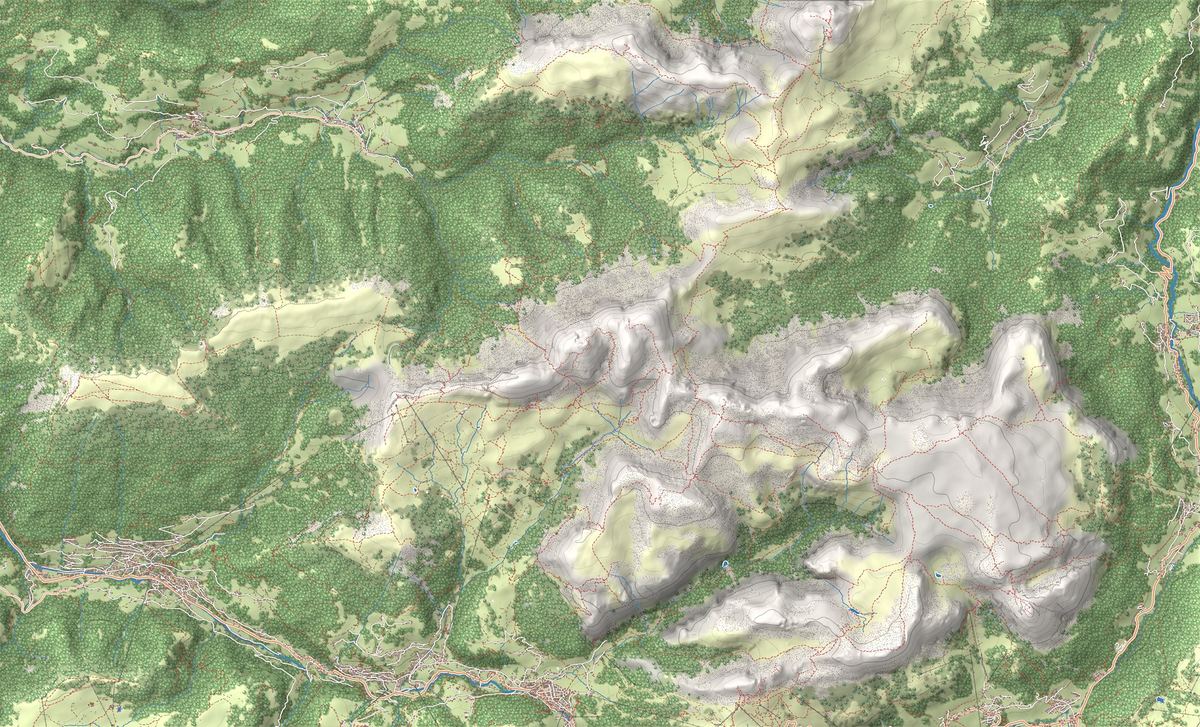
- 1Seceda Loop from Ortisei: the balcony above the Odle
- 2Adolf Munkel Trail: trekking at the foot of the Odle
- 3Snowshoeing in Vallunga: the snow-covered valley of Val Gardena
- 4Col Raiser and Rifugio Firenze: trekking at the foot of the Odle
- 5Malga Glatsch (Glatschalm)
- 6Rifugio Firenze (Regensburger)
- 7Altopiano del Seceda
- 8Vallunga
- 9Centro storico di Ortisei
- 10Sentiero Adolf Munkel ai piedi delle Odle
- 11Belvedere di Santa Maddalena
- 12Malga Glatsch e i pascoli del Puez-Odle
- 13Chiesetta di San Giovanni in Ranui
- 14Ortisei
The best-known peaks
- Sass Rigais3,025 m
- Furchetta3,025 m
- Sas dla Porta2,967 m
- Grande Fermeda2,873 m
- Monte Seceda2,519 m
Elevations from the map (OpenStreetMap).
How it is built: rows of rock needles
The Dolomites UNESCO Foundation distinguishes two massifs: the Odle di Funes, dominated by Sass Rigais, and the Odle di Eores, where the nearby Sas de Putia stands out. The shapes have a geological explanation: the spires follow the regular grid of fractures that cut the rock, and the faults running north-east to south-west set the direction of Val di Funes itself.
On the Val Gardena side the walls drop onto the grassy uplands of the Seceda and the Cisles alp, home to Rifugio Firenze. On the Funes side the north faces fall onto forests and alpine pastures.
Where to see it from and how to get there
In Val di Funes the base is Santa Maddalena, at 1,339 metres: the church with the Odle behind it is a view the tourist board calls world-famous. Nearby is the chapel of San Giovanni in Ranui, standing alone in front of the peaks, and Santa Maddalena also has the nature park visitor centre. Further up the valley, from the Zannes area, the Adolf Munkel trail runs beneath the north faces.
In Val Gardena the lifts from Ortisei go up to the Seceda. From Santa Cristina the gondola takes you to Col Raiser, at 2,107 metres according to the South Tyrol tourist board, and from there Rifugio Firenze is a short walk across the meadows.
What to do: trails and a via ferrata
The easiest routes are on the Val Gardena side: the Seceda loop and the walk from Col Raiser to Rifugio Firenze. The Adolf Munkel trail, on the Funes side, is easy but long.
Sass Rigais is climbed by via ferrata. The Val Gardena route starts at Col Raiser, passes Rifugio Firenze and climbs Val dla Salieries to the start of the cables, between Furchetta and Sass Rigais: 1,105 metres of ascent and 6 hours 30 on the move, rated moderate. If you are new to via ferratas, start with our via ferrata guide.
History: Reinhold Messner's first climbs
According to the Val di Funes tourist board, the Odle walls were drawing climbers as early as the 19th century. This is also the valley where Reinhold Messner grew up: he spent his childhood in San Pietro, where his father was the village schoolmaster, and at the age of five he climbed Sass Rigais with him. The Dolomites UNESCO Foundation writes that this is where his career began. Today he is an honorary citizen of the valley.
Names, park and UNESCO World Heritage
In Ladin the peaks are the Odles, in German the Geisler, and the group is the Geislergruppe. The park, Naturpark Puez-Geisler in German, was established in 1978, covers 10,729 hectares and runs from the Passo delle Erbe to the Passo Gardena.
The Puez-Odle system of the Dolomites UNESCO site, 7,930 hectares, lies entirely within the park. The Foundation presents it as a geology book: the sequence of Dolomites rocks from the Permian to the Cretaceous is exposed here almost complete and barely deformed.
Trails in the group
 E · Hiking
 E · Hiking
 T · Easy / Tourist
 E · Hiking
Trail · Val Gardena
Col Raiser and Rifugio Firenze: trekking at the foot of the Odle
2 h 30↑ 300 m8 km
Mountain huts
 1,902 m
 2,040 m
Things to see

Sight · Val Gardena
Altopiano del Seceda
The most photographed ridge in the Dolomites: the Odle peaks rising over the Seceda plateau, minutes from the cable car arrival above Ortisei.

Sight · Val Gardena
Vallunga
A broad, near-flat valley behind Selva, the way into the Puez-Odle Park and a perfect walk if you want the Dolomites without the hard slog.

Sight · Val Gardena
Centro storico di Ortisei
The pedestrian heart of Val Gardena, where Ladin culture and a centuries-old wood-carving tradition meet under the arcades, in the shops and in the cafés.

Sight · Val di Funes
Sentiero Adolf Munkel ai piedi delle Odle
The signature trail of Val di Funes: an easy loop under the north walls of the Odle, through forests, clearings and farmhouses where you can stop for a meal.

Sight · Val di Funes
Belvedere di Santa Maddalena
The viewpoint behind the most famous postcard of Val di Funes: the village and its church in the meadows, with the long arc of the Odle closing the horizon.

Sight · Val di Funes
Malga Glatsch e i pascoli del Puez-Odle
An alpine dairy at almost 1,900 metres at the foot of the Odle, reached on a gentle walk through the forest: a good easy hike and a fine stop for local food.

Sight · Val di Funes
Chiesetta di San Giovanni in Ranui
The little baroque church with the Odle peaks rising behind it: one of the most photographed views in the Dolomites.

Sight · Val Gardena
Ortisei
The main town of Val Gardena: a pedestrian center, woodcarving workshops, and the lifts that take you up to Seceda and the Alpe di Siusi in minutes.
Nearby
Places that fall inside the group’s frame but are closer to another group.
Frequently asked questions
How high are the Odle?
The highest peaks are Sass Rigais and Furchetta, both 3,025 metres high according to the Val di Funes tourist board.
Where can you see the Odle with the little church?
From Santa Maddalena, in Val di Funes, at 1,339 metres: the church with the Odle behind it is a view the tourist board calls world-famous. Nearby stands the chapel of San Giovanni in Ranui, alone in front of the peaks. The viewpoint has its own page.
How do you get up to the Seceda?
From Ortisei, in Val Gardena, with the lifts that go up to the Seceda. From the top station starts the Seceda loop, with views of the south side of the Odle.
Can you climb Sass Rigais?
Yes, by via ferrata, and it is a long day. The Val Gardena route starts at Col Raiser and has 1,105 metres of ascent and 6 hours 30 on the move. You need via ferrata gear and experience.
Are the Odle in a nature park?
Yes, in the Puez-Odle Nature Park, 10,729 hectares established in 1978. The visitor centre is in Santa Maddalena, in Val di Funes.
Are the Odle a UNESCO World Heritage Site?
Yes, they belong to system 6, Puez-Odle, one of the nine systems of the Dolomites UNESCO site. The system covers 7,930 hectares and lies entirely within the nature park.