
The Puez Group lies between Val Gardena and Val Badia, north of Passo Gardena. It is less a row of peaks than a plateau: the Dolomites UNESCO Foundation describes it at 2,500 metres, with pastures and small lakes, ringed by rock walls. The highest summit is the eastern top of Piz de Puez, 2,913 metres, according to the Alpenverein Südtirol.
The group, with the Vallunga valley and the neighbouring Cir group, lies within the Puez-Odle Nature Park and the Puez-Odle system of the UNESCO World Heritage site. You start from Selva and Santa Cristina in Val Gardena, from Passo Gardena, from Colfosco and La Villa in Alta Badia, or from Longiarù.
The peaks, huts and routes on this site are listed further down, with the map.
On the map
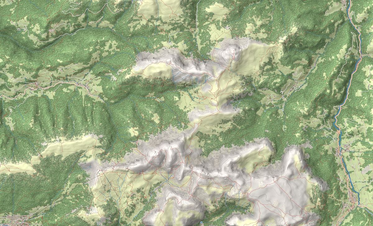
The best-known peaks
- Piz de Puez2,913 m
Elevations from the map (OpenStreetMap).
How it is built: the lunar plateau
The Dolomites UNESCO Foundation describes two broad plateaus, Puez and Gardenaccia, ringed by peaks such as the Sassongher, above Corvara. On the plateaus stand mounds of soft, dark Cretaceous rock, among the youngest in the Dolomites and rich in ammonites. Col de la Sonè, a pyramid on the plateau, is the last remnant of the Puez marls that once covered the whole Gardenaccia.
The San Vigilio and San Martino tourist board speaks of natural amphitheatres, caves, arches and pinnacles; the Val Gardena tourist office of a lunar landscape. The Vallunga, which runs down to Selva, follows one of the faults that cut the group from north-east to south-west.
Where to start
No roads or lifts reach Rifugio Puez: you can only get there on foot. These are the ascents described by the tourist boards and the hut:
- From Selva up the Vallunga and trail 14. The South Tyrol tourist board allows 3 hours for the descent from the hut to Selva.
- From Selva with the Dantercëpies gondola: trail 12A below the Cir peaks, then Alta Via 2 over Passo Cir and Passo Crespëina, with its lake, and on to the hut. The return goes down the Vallunga.
- From Santa Cristina with the Col Raiser gondola and Rifugio Firenze, then trail 2 over Forcella de Sieles, partly protected with cables: 3 hours from Rifugio Firenze. The tourist board rates it a difficult hike.
- From Val Badia: from Longiarù through the Antersasc valley, or from Rifugio Gardenacia on trail 11, which the Puez hut lists as its eastern approach.
Rifugio Puez and the Alta Via 2
Rifugio Puez stands at 2,475 metres on the plateau, on the Alta Via delle Dolomiti no. 2, which runs from Bressanone to Feltre. The German and Austrian Alpine Club built it in 1889; after the First World War it passed to the Bolzano section of the Italian Alpine Club, which built a new hut next to it, opened on 8 August 1982 in the presence of President Sandro Pertini.
On 17 September 2026 the hut's website warned that, because of a water shortage, water is sold only in bottles: set off with a full water bottle. How to plan a multi-day tour with nights at altitude is explained in our guide to going from hut to hut.
In winter and on skis
In winter you can snowshoe along the floor of the Vallunga: the route is on the Vallunga snowshoe page. On the eastern Piz de Puez, the Alpenverein Südtirol describes a ski tour up the Canale Nord, long and demanding, with 1,440 metres of ascent: it is for fit ski tourers, and you check the avalanche bulletin before setting off.
Names, park and UNESCO World Heritage
In German the group is the Puezgruppe, the Vallunga is the Langental and the hut the Puezhütte; the UNESCO Foundation also uses the Ladin name of the valley, Val Longia. Longiarù, Lungiarü in Ladin, a hamlet of San Martino in Badia, has been the first mountaineering village in the Dolomites since 2018, part of a network started by the alpine clubs.
The Puez-Odle Nature Park was established in 1978 and covers 10,729 hectares. The Puez-Odle system of the Dolomites UNESCO site, 7,930 hectares, lies entirely within the park and also includes the neighbouring Odle.
Passes
 1,987 m
Nearby
Places that fall inside the group’s frame but are closer to another group.
- Altopiano del Seceda
- Centro storico di Ortisei
- Sentiero Adolf Munkel ai piedi delle Odle
- Belvedere di Santa Maddalena
- Malga Glatsch e i pascoli del Puez-Odle
- Chiesetta di San Giovanni in Ranui
- Ortisei
- Seceda Loop from Ortisei: the balcony above the Odle
- Adolf Munkel Trail: trekking at the foot of the Odle
- Col Raiser and Rifugio Firenze: trekking at the foot of the Odle
- Malga Glatsch (Glatschalm)
- Rifugio Firenze (Regensburger)
Frequently asked questions
What is the highest peak of the Puez Group?
The eastern top of Piz de Puez, which the Alpenverein Südtirol gives as 2,913 metres and names as the highest in the group.
How do you get to Rifugio Puez?
Only on foot: from Selva up the Vallunga or from the Dantercëpies gondola, from Santa Cristina via Rifugio Firenze, from Val Badia from Longiarù or Rifugio Gardenacia.
Can you stay overnight at Rifugio Puez?
Yes, the hut offers overnight stays and is a base on the Alta Via 2. Opening dates and bookings are on the hut's website. On 17 September 2026 the hut warned that, because of a water shortage, water is sold only in bottles.
Is the Puez Group in a nature park?
Yes. The Province of Bolzano places the Puez group with the Vallunga, the Cir group and the Gherdenacia and Sassongher plateaus in the Puez-Odle Nature Park. The park visitor centre is in Santa Maddalena, in Val di Funes.
Why is the Puez called a lunar landscape?
That is how the Val Gardena tourist office describes the plateau. The San Vigilio and San Martino tourist board speaks of amphitheatres, caves, arches and pinnacles; the Dolomites UNESCO Foundation points to the mounds of soft, dark rock, such as Col de la Sonè, among the youngest in the Dolomites.
Is the Puez a UNESCO World Heritage Site?
Yes. It belongs to system 6, Puez-Odle, one of the nine systems of the Dolomites UNESCO site, which lies entirely within the nature park.