
The Marmolada is the highest mountain in the Dolomites: Punta Penia reaches 3,343 metres. It sits on the border between the provinces of Trento and Belluno, between Val di Fassa and Val Pettorina, and is known as the Queen of the Dolomites.
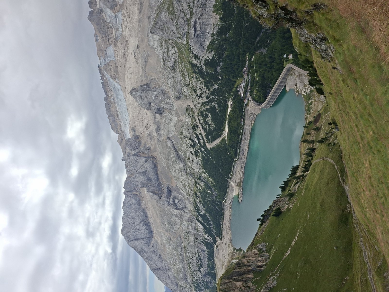
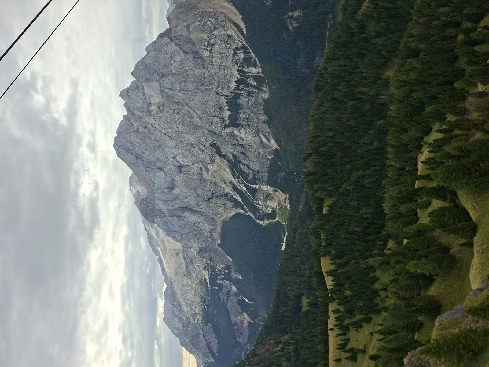
It has two faces. To the north a regular slope, covered by the largest glacier in the Dolomites, runs down to Lake Fedaia; to the south, writes the Dolomites UNESCO Foundation, a wall of almost 1,000 metres rises from the scree of Val Ombretta and is one of the most sought-after routes for climbers.
Non-climbers go up by cable car from Malga Ciapela to Punta Rocca. The group’s peaks, routes and sights are listed further down.
On the map
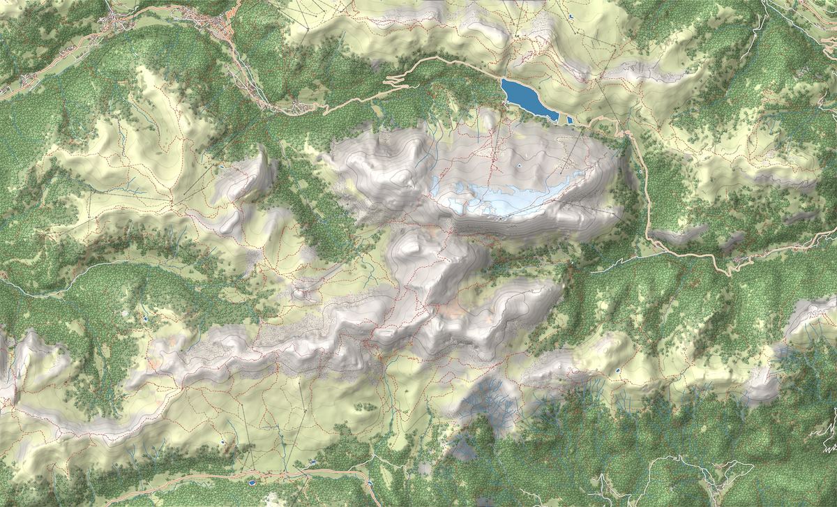
- 1Viel del Pan Trail: the balcony overlooking the Marmolada
- 2Via Ferrata delle Trincee: history and rock on the Padon Ridge
- 3Serrai di Sottoguda: ice climbing beneath the Marmolada
- 4Ghiacciaio della Marmolada e Punta Rocca in funivia
- 5Val San Nicolò
- 6Museo della Grande Guerra in quota
- 7Sentiero del Viel del Pan
- 8Serrai di Sottoguda
The best-known peaks
- Punta Penia3,343 m
- Punta Rocca3,310 m
- Gran Vernel3,210 m
- Sasso Vernale3,058 m
Elevations from the map (OpenStreetMap).
The glacier
The glacier is enclosed at the top by the ridges of Punta Rocca and Punta Penia. According to the UNESCO Foundation’s geology sheet it covered 305 hectares in the early 1960s and 170 in 2006, and its front has retreated above the Sasso delle Undici and Sasso delle Dodici, the rock spurs that used to divide its sectors.
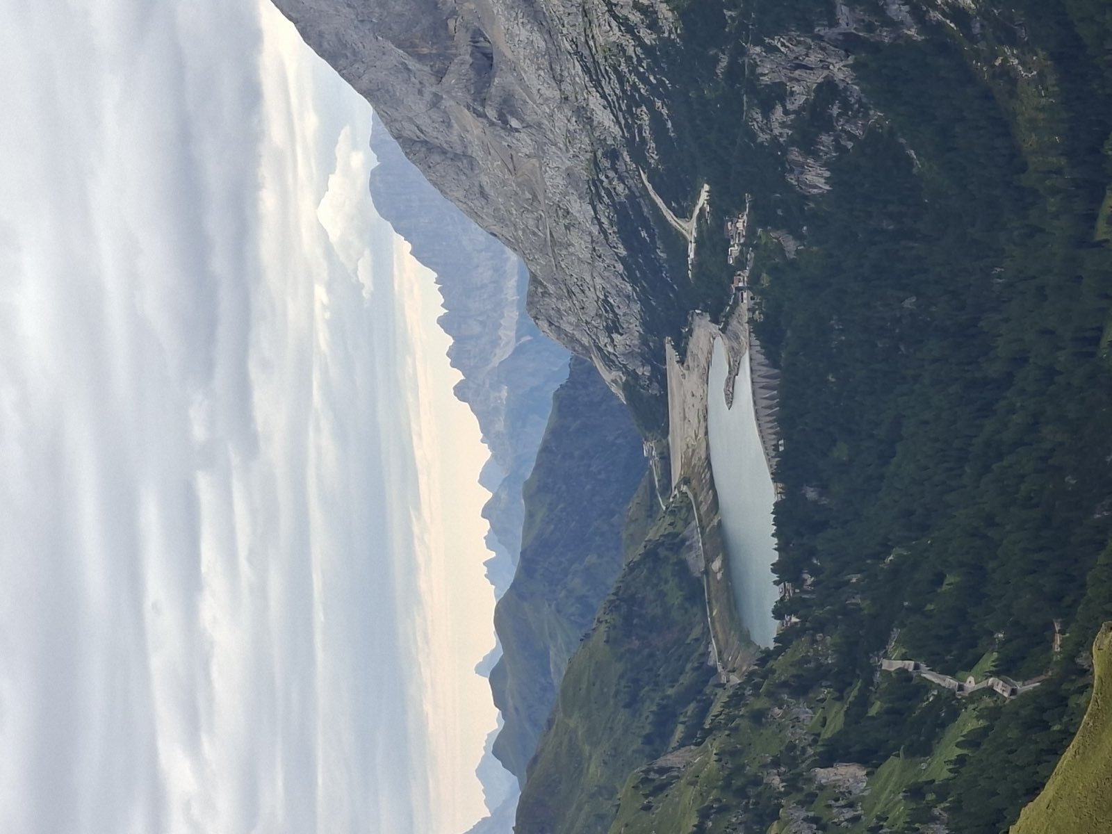
The massif also includes the Gran Vernel and the Ombretta and Val Fredda peaks. Lake Fedaia, at the foot of the north side, is a reservoir: since 1950 the meltwater has been used to generate electricity.
The cable car and access
At Malga Ciapela, in the municipality of Rocca Pietore, the cable car climbs in 12 minutes from 1,450 to 3,265 metres, with intermediate stations at Coston d’Antermoja and Serauta. The first section, up to Serauta, opened on 8 December 1967. At Punta Rocca the viewing terrace is reached by lift; the operator asks visitors to set off by 3.30 pm. In winter La Bellunese runs down from Punta Rocca, 12 km and 1,810 metres of descent, crossing the glacier and passing the Fedaia Pass.
From Val di Fassa you drive up from Canazei to the Fedaia Pass, on the border between Trentino and Veneto. The best-known viewpoint over the north side is the Viel del Pan. Punta Penia, on the other hand, is for experienced mountaineers: Visit Trentino advises against climbing it without a mountain guide, and the cable car operator forbids heading out onto the glacier without proper equipment.
The Great War
According to Visit Trentino, the Marmolada was the highest battlefield on the Dolomite front. The Austro-Hungarian army dug the City of Ice into the glacier, tunnels linking the bases at the foot of the mountain with the positions at Punta Rocca and Forcella V. Today, writes the Val di Fassa tourist board, nothing of it remains.
Its story is told at the Marmolada Great War museum, at Serauta station: renovated in 2015, it has 300 square metres of photos, diaries and finds that emerged from the ice. At the Fedaia Pass there is another Great War museum, with finds that come largely from the Marmolada.
The collapse of 3 July 2022
On 3 July 2022, at 1.43 pm, part of the glacier broke away near Punta Rocca and swept over several roped parties: 11 people died. According to estimates by the Autonomous Province of Trento, 63,300 cubic metres of ice fell at 50-80 metres per second, with rock and debris, over 2.2 kilometres.
On 8 July the Province declared a state of emergency. On 16 November 2022 the mayor of Canazei lifted the red zone on the north side, and Trentino’s civil protection defined an attention area, from the ice cap down to Lake Fedaia, where access can be banned again during long hot spells. In June 2023 the Province wrote that the causes were still being studied. Before heading up the north side, check the ordinances of the Municipality of Canazei.
Names and UNESCO World Heritage
According to the Val di Fassa tourist board, the nickname Queen of the Dolomites was coined by Father Luigi Baroldi in 1883. In German the form Marmolata is also used, and it appears on the cable car’s German website. Since 2009 the Marmolada has been System 2 of the Dolomites UNESCO World Heritage Site: 2,208 hectares across the provinces of Belluno and Trento.
Trails in the group
 E · Hiking
Trail · Arabba e Marmolada
Viel del Pan Trail: the balcony overlooking the Marmolada
2 h 30↑ 200 m7 km
 EEA · Via ferrata / Expert
Trail · Arabba e Marmolada
Via Ferrata delle Trincee: history and rock on the Padon Ridge
4 h 30↑ 500 m7 km
 EEA · Via ferrata / Expert
Things to see
Sight · Arabba e Marmolada
Ghiacciaio della Marmolada e Punta Rocca in funivia
The Queen of the Dolomites is within reach without being a mountaineer: the cable car leaves Malga Ciapela and climbs in three stages to the Punta Rocca terrace, above 3,250 metres, between the retreating glacier, the Madonna chapel and the Great War museum cut into the front line.

Sight · Val di Fassa
Val San Nicolò
The best-loved side valley of Val di Fassa: a wide green basin of meadows, farmhouses and waterfalls behind Pozza, where you leave the car at the entrance and walk in the quiet.

Sight · Arabba e Marmolada
Museo della Grande Guerra in quota
The highest museum in Europe, suspended at 3,000 metres, tells the story of the war fought inside the glacier.

Sight · Arabba e Marmolada
Sentiero del Viel del Pan
The finest panoramic balcony overlooking the Marmolada, the ancient bread route between Pordoi and Fedaia.

Sight · Arabba e Marmolada
Serrai di Sottoguda
A narrow gorge carved by the Pettorina stream, with tall walls and waterfalls, running between the village of Sottoguda and Malga Ciapela at the foot of the Marmolada.
Frequently asked questions
How high is the Marmolada?
Punta Penia, the highest peak, is 3,343 metres: it is the highest mountain in the Dolomites. The cable car reaches Punta Rocca station, at 3,265 metres.
Where does the Marmolada cable car start?
From Malga Ciapela, on the Belluno side, at 1,450 metres. In 12 minutes it reaches Punta Rocca via Coston d’Antermoja and Serauta. The car park is next to the valley station.
Can you climb Punta Penia?
Only with mountaineering experience. Visit Trentino advises against the routes without a mountain guide, and from Punta Rocca station you may not head out onto the glacier without equipment.
What happened on the Marmolada in 2022?
On 3 July 2022 part of the glacier broke away near Punta Rocca and swept over several roped parties: 11 people died. The north side was closed and reopened on 16 November 2022, with an attention area where access can be banned during the hottest periods.
Is the Marmolada glacier retreating?
Yes. According to the Dolomites UNESCO Foundation it covered 305 hectares in the early 1960s and 170 in 2006. It is still the largest glacier in the Dolomites.
What is the Marmolada called in German?
Marmolata. Many German-language sites also use the Italian name, Marmolada.