
The Catinaccio is the group between Val di Fassa, the Eggental (Val d’Ega) and the Tiers valley (Val di Tires), straddling Trentino and South Tyrol. In German it is called Rosengarten, the rose garden, and its west face can be seen even from Bolzano.
The highest peak is the Catinaccio d’Antermoia (Kesselkogel): 3,002 metres according to the nature park, 3,004 according to the Eggental tourist board. The best-known sights are the Vajolet Towers and the walls that turn red at sunset, the enrosadira.
The Tires side lies in the Sciliar-Catinaccio Nature Park. The group’s peaks, huts and routes are listed further down.
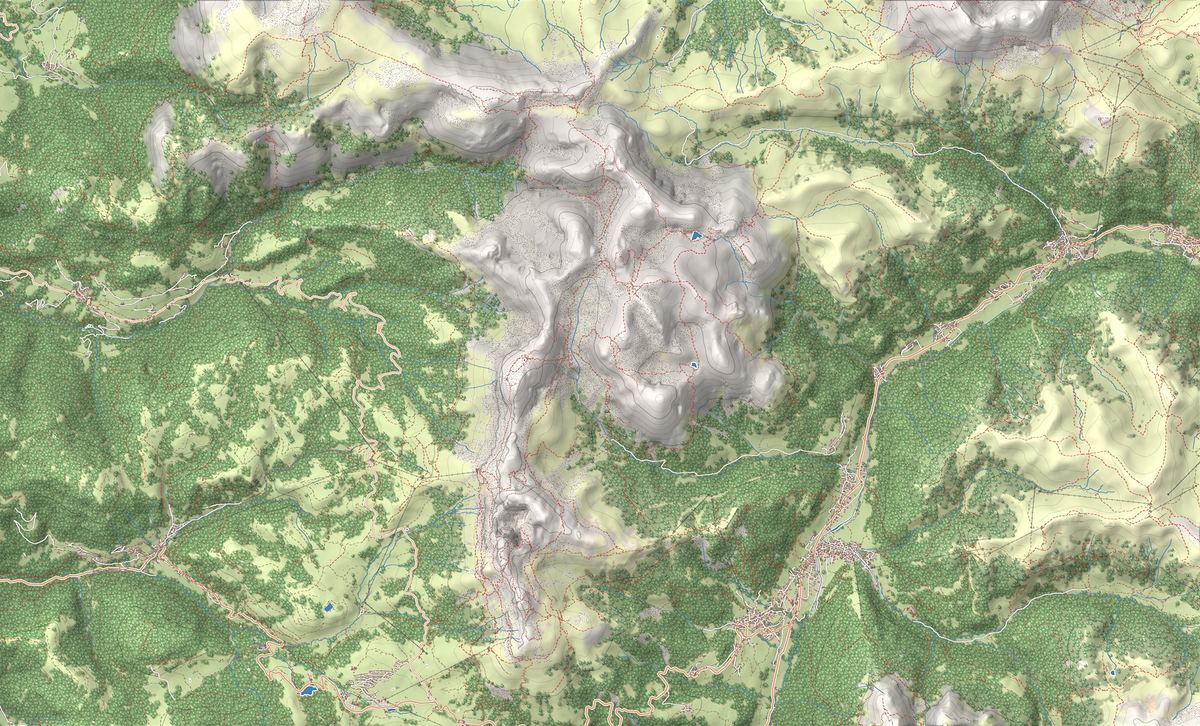
On the map
- 1Rifugio Vajolet and the Torri del Vajolet in the Catinaccio
- 2Ascent of the Sciliar to Rifugio Bolzano from the Alpe di Siusi
- 3Rifugio Vajolet
- 4Rifugio Bolzano allo Sciliar
- 5Rifugio Alpe di Tires
- 6Catinaccio e il Giardino delle Rose al tramonto
- 7Rifugio Vajolet e le Torri del Vajolet
- 8Sciliar e Denti di Terrarossa
The best-known peaks
- Catinaccio d'Antermoia3,004 m
- Cima Catinaccio2,981 m
- Croda di Re Laurino2,813 m
- Roda di Vaèl2,806 m
- Torre Winkler2,800 m
Elevations from the map (OpenStreetMap).
What the Catinaccio is like
It is a long, jagged ridge of dolomite. Among the peaks that come close to 3,000 metres, the Dolomites UNESCO Foundation names the Catinaccio d’Antermoia, Cima Scalieret, the Vajolet Towers and the Roda di Vaèl.
For the Foundation it is, with the Sciliar and the Latemar, one of three fossil atolls from the Triassic brought back to light by erosion, and since the 19th century one of the most studied places for Triassic stratigraphy. Since 2009 it has been a UNESCO World Heritage Site in System 7, 9,302 hectares across the provinces of Trento and Bolzano.
The Sciliar: same park, separate group
The Sciliar (Schlern) is the flat-topped massif beside the Alpe di Siusi, with the Santner and Euringer peaks. Its highest point, according to the Alpe di Siusi tourist board, is the Petz: 2,563 metres.
The sources treat it as a separate group. The UNESCO Foundation counts three groups in the Sciliar-Catinaccio, Latemar system, the tourist boards speak of two massifs, and the SOIUSA classification lists them side by side among the Fassa Dolomites. On this map the Sciliar falls within the Catinaccio frame: that is why the Bolzano Hut and the Sciliar trail are listed here.
The park brings them together. Created on 16 September 1974 as the Sciliar park, the first in South Tyrol, it was extended to the Catinaccio in 2003. It covers 7,288 hectares in the municipalities of Castelrotto, Tires and Fiè allo Sciliar.
Where to start
In Val di Fassa the gateway is Vigo di Fassa, with the cable car to Ciampedìe, a terrace at 2,000 metres. From Pera di Fassa the Vajolet and Pian Pecei chairlifts go up, and the Gardeccia hut is reached by shuttle bus: from Gardeccia and Pian Pecei starts the walk up to the Vajolet huts.
In the Eggental, from Nova Levante (Welschnofen), the König Laurin gondola has run since June 2021 to the Fronza alle Coronelle hut (Kölner Hütte), at 2,337 metres. To the south the Costalunga Pass (Karerpass) separates the Catinaccio from the Latemar, near Lake Carezza; in winter that is where the Carezza ski area is.
Via ferratas, towers and first ascents
According to the Eggental tourist board, the group has 500 kilometres of trails and 7 via ferratas. Grades and gear are covered in the via ferrata guide.
Visit Trentino recalls the first ascents: the Catinaccio d’Antermoia in 1872, by the Englishmen Charles Comyns-Tucker and Thomas Carson with the Fassa guide Luigi Bernard, and the Cima Catinaccio on 31 August 1874, with the Chamonix guide François Dévouassoud. The Vajolet Towers are linked to Georg Winkler and Tita Piaz.
Piaz, a guide from Fassa, built next to the Vajolet hut the hut dedicated to his friend Paul Preuss. Its enlargement, halted by the First World War, was finished in 1925, and the Piaz family still runs it.
Enrosadira and King Laurin
At sunset the walls turn pink and red: this is the enrosadira. In the legend told by Visit Trentino and the Eggental tourist board, Laurin, king of the dwarfs, kidnaps Princess Similde and takes her to his kingdom, where he tends a rose garden. When the knights come to free her, he turns the roses to stone, hidden by day and by night. But he forgets the sunset.
You can watch it from Ciampedìe, from Val di Fassa or from the Alpe di Siusi; places and times are in the sunrise and sunset guide.
Trails in the group
 EE · Experienced hikers
 EE · Experienced hikers
Trail · Alpe di Siusi (Seiser Alm)
Ascent of the Sciliar to Rifugio Bolzano from the Alpe di Siusi
6 h↑ 939 m16.6 km
Mountain huts
 2,243 m
 2,457 m
 2,440 m
Things to see

Sight · Val di Fassa
Catinaccio e il Giardino delle Rose al tramonto
As the sun goes down, the walls of the Catinaccio turn from rose to fiery red. This is the enrosadira, the effect Ladin legend ties to King Laurino's cursed rose garden.
Sight · Val di Fassa
Rifugio Vajolet e le Torri del Vajolet
Three near-vertical spires at the heart of the Catinaccio, with refuges at their feet that shaped climbing history, in one of the most dramatic rock amphitheatres in Val di Fassa.
Sight · Alpe di Siusi (Seiser Alm)
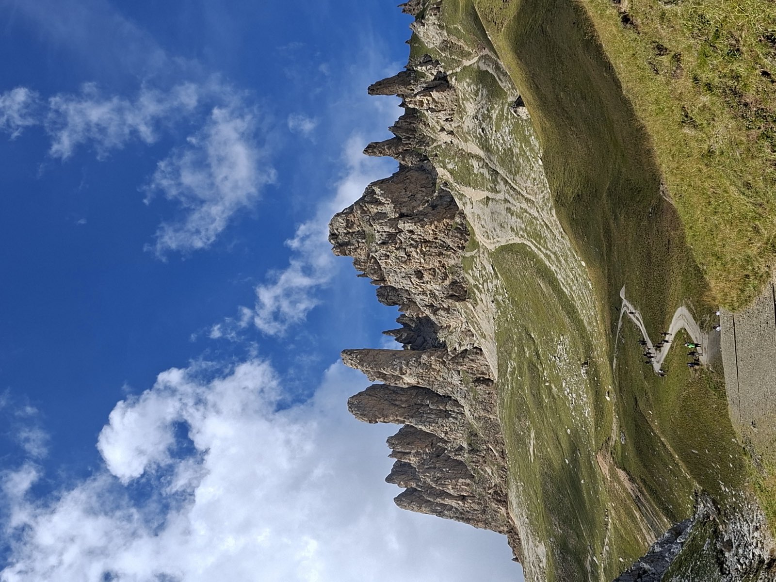
Sciliar e Denti di Terrarossa
South Tyrol's signature mountain: the flat-topped Sciliar massif, crowned by the twin towers of Santner and Euringer, with the jagged spires of the Denti di Terrarossa just beyond.
Nearby
Places that fall inside the group’s frame but are closer to another group.
Frequently asked questions
How high is the Catinaccio?
The highest peak is the Catinaccio d’Antermoia, Kesselkogel in German: 3,002 metres according to the Sciliar-Catinaccio Nature Park, 3,004 according to the Eggental tourist board.
Is the Sciliar part of the Catinaccio?
No. The Dolomites UNESCO Foundation and the SOIUSA classification treat it as a separate group. The two massifs do, however, share the same nature park and the same UNESCO system.
How do you get to the Vajolet Towers?
From Vigo di Fassa with the Ciampedìe cable car, from Pera di Fassa with the chairlifts up to Pian Pecei, or by shuttle bus to the Gardeccia hut. From Gardeccia and Pian Pecei you walk up to the Preuss and Vajolet huts.
What is the Catinaccio called in German?
Rosengarten. The Catinaccio d’Antermoia is the Kesselkogel, the Vajolet Towers are the Vajolet-Türme and the Roda di Vaèl is the Rotwand.
What is the enrosadira on the Catinaccio?
It is the pink and red colour of the walls at sunset. The legend explains it with King Laurin’s garden, turned to stone by a curse that held by day and by night, but not at sunset.